Cândeşti Vale geodata
Cândeşti Vale (Dâmboviţa) is a seat of a second-order administrative division; located in Romania in Europe/Bucharest (GMT+3) time zone. In our database, there are 7076 cities with bigger population. Compared to other cities in Romania, 66.4% of cities are located further ↑North; 50.1% of cities are located further ←West and 84.6% of cities have lower elevation than Cândeşti Vale. Note1


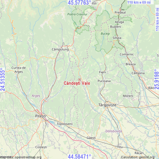
Cândeşti Vale GPS coordinates[2]
45° 4' 59.988" North, 25° 13' 0.012" East
| Map corner | latitude | longitude |
|---|---|---|
| Upper-left | 45.57763°, | 24.51355° |
| Center: | 45.08333°, | 25.21667° |
| Lower-right: | 44.58471°, | 25.9198° |
| Map W x H: | 110.4×110.4 km | = 68.6×68.6mi |
| max Lat: | 48.23793° ⇑66.4% North |
| Cândeşti Vale: | 45.08333° |
| min Lat: | ⇓33.6% South 43.65638° |
| min Long | Cândeşti Vale | max Long |
| 20.31667° | 25.21667° | 29.65403° |
| W 50.1%⇐ | ⇒49.9% E |
Elevation
Elevation of Cândeşti Vale is 442 m = 1450 ft, and this is 187.1 m = 614 ft above average elevation for this country.
| Max E: |
1278 m = 4193 ft | 15.4% |
| Cândeşti Vale | 442 m 1450 ft | |
| Avg. | 254.9 m = 836 ft | |
Min E: |
-2 m = -7 ft | 84.6% |
See also: Romania elevation on elevation.city.
Geographical zone
Cândeşti Vale is located in North temperate zone (between Tropic of Cancer and the Arctic Circle). Distance of this North polar circle is 2388.4 km =1484.1 mi to North.| Distance of | km | miles | from Cândeşti Vale |
|---|---|---|---|
| North Pole | 4994.3 | 3103.3 | to North |
| Arctic Circle | 2388.4 | 1484.1 | to North |
| Tropic Cancer | 2406.9 | 1495.6 | to South |
| Equator | 5012.8 | 3114.8 | to South |


Nearby cities:
15 places around Cândeşti Vale: (largest is in red/bold)
• Bărbuleţu
8.6 km =5.3 mi,  49°
49°
• Dragodănești
3.5 km =2.2 mi,  153°
153°
• Gemenea Brătulești
3 km =1.9 mi,  22°
22°
• Gura Bărbulețului
7.8 km =4.8 mi,  57°
57°
• Izvoarele
6.8 km =4.2 mi,  144°
144°
• Lăicăi
9.5 km =5.9 mi,  354°
354°
• Malu cu Flori
7.5 km =4.7 mi, 349°
• Manga
4.9 km =3 mi,  107°
107°
• Oncești
2.9 km =1.8 mi,  356°
356°
• Pietrari
6.1 km =3.8 mi,  79°
79°
• Priboiu
6.8 km =4.2 mi, 151°
• Suduleni
6.3 km =3.9 mi,  125°
125°
• Valea
4.5 km =2.8 mi, 51°
• Voineşti
3.2 km =2 mi, 125°
• Văleni-Dâmbovița
9.6 km =6 mi,  344°
344°
Sources, notices
• [Note1] Compared only with cities in Romania existing in our database
• [Src1] Map data: © OpenStreetMap contributors (CC-BY-SA)
• [Src2] Other city data from geonames.org with taken over terms of usage.
• [Src3] Geographical zone / Annual Mean Temperature by Robert A. Rohde @ Wikipedia
