Bărbuleţu geodata
Bărbuleţu (Dâmboviţa) is a seat of a second-order administrative division; located in Romania in Europe/Bucharest (GMT+3) time zone. With population of 6,777 people, there are 431 cities with bigger population in this country. Compared to other cities in Romania, 64.2% of cities are located further ↑North; 51.3% of cities are located further ←West and 88.7% of cities have lower elevation than Bărbuleţu. Note1


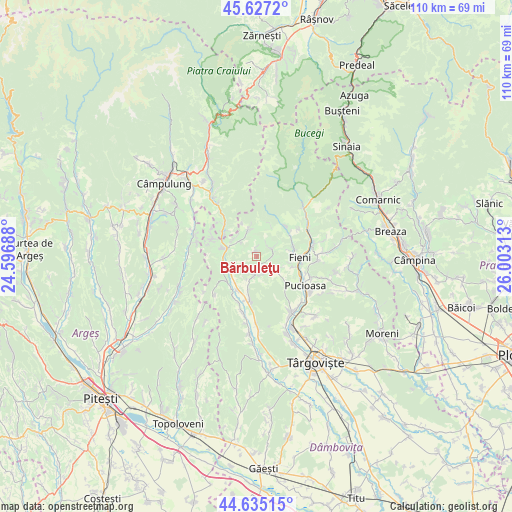
Bărbuleţu GPS coordinates[2]
45° 7' 59.988" North, 25° 18' 0" East
| Map corner | latitude | longitude |
|---|---|---|
| Upper-left | 45.6272°, | 24.59688° |
| Center: | 45.13333°, | 25.3° |
| Lower-right: | 44.63515°, | 26.00313° |
| Map W x H: | 110.3×110.3 km | = 68.5×68.5mi |
| max Lat: | 48.23793° ⇑64.2% North |
| Bărbuleţu: | 45.13333° |
| min Lat: | ⇓35.8% South 43.65638° |
| min Long | Bărbuleţu | max Long |
| 20.31667° | 25.3° | 29.65403° |
| W 51.3%⇐ | ⇒48.7% E |
Elevation
Elevation of Bărbuleţu is 492 m = 1614 ft, and this is 237.1 m = 778 ft above average elevation for this country.
| Max E: |
1278 m = 4193 ft | 11.3% |
| Bărbuleţu | 492 m 1614 ft | |
| Avg. | 254.9 m = 836 ft | |
Min E: |
-2 m = -7 ft | 88.7% |
See also: Romania elevation on elevation.city.
Geographical zone
Bărbuleţu is located in North temperate zone (between Tropic of Cancer and the Arctic Circle). Distance of this North polar circle is 2382.8 km =1480.6 mi to North.| Distance of | km | miles | from Bărbuleţu |
|---|---|---|---|
| North Pole | 4988.7 | 3099.8 | to North |
| Arctic Circle | 2382.8 | 1480.6 | to North |
| Tropic Cancer | 2412.4 | 1499 | to South |
| Equator | 5018.4 | 3118.3 | to South |


Nearby cities:
15 places around Bărbuleţu: (largest is in red/bold)
• Brebu
7.1 km =4.4 mi,  27°
27°
• Cetățuia
3.1 km =1.9 mi,  356°
356°
• Costești
7.2 km =4.5 mi,  79°
79°
• Cucuteni
8.2 km =5.1 mi,  103°
103°
• Gemenea Brătulești
6 km =3.7 mi,  242°
242°
• Gura Bărbulețului
1.3 km =0.8 mi,  177°
177°
• Malu cu Flori
8.1 km =5 mi,  283°
283°
• Manga
7.3 km =4.5 mi,  194°
194°
• Oncești
7.3 km =4.5 mi,  248°
248°
• Pietrari
4.4 km =2.7 mi, 187°
• Pucheni
5.7 km =3.5 mi,  346°
346°
• Râu Alb de Jos
3.7 km =2.3 mi, 84°
• Râu Alb de Sus
3.7 km =2.3 mi, 34°
• Valea
4.1 km =2.5 mi,  227°
227°
• Vulcana de Sus
5.8 km =3.6 mi,  127°
127°
Sources, notices
• [Note1] Compared only with cities in Romania existing in our database
• [Src1] Map data: © OpenStreetMap contributors (CC-BY-SA)
• [Src2] Other city data from geonames.org with taken over terms of usage.
• [Src3] Geographical zone / Annual Mean Temperature by Robert A. Rohde @ Wikipedia
