Câmpurelu geodata
Câmpurelu (Giurgiu) is a populated place; located in Romania in Europe/Bucharest (GMT+3) time zone. With population of 1,546 people, there are 3117 cities with bigger population in this country. Compared to other cities in Romania, 92.4% of cities are located further ↑North; 66.7% of cities are located further ←West and 91.8% of cities have higher elevation than Câmpurelu. Note1


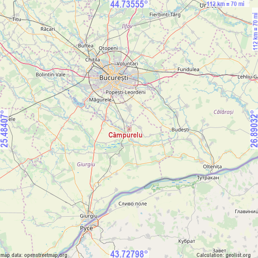
Câmpurelu GPS coordinates[2]
44° 14' 2.112" North, 26° 11' 13.884" East
| Map corner | latitude | longitude |
|---|---|---|
| Upper-left | 44.73555°, | 25.48407° |
| Center: | 44.23392°, | 26.18719° |
| Lower-right: | 43.72798°, | 26.89032° |
| Map W x H: | 112×112 km | = 69.6×69.6mi |
| max Lat: | 48.23793° ⇑92.4% North |
| Câmpurelu: | 44.23392° |
| min Lat: | ⇓7.6% South 43.65638° |
| min Long | Câmpurelu | max Long |
| 20.31667° | 26.18719° | 29.65403° |
| W 66.7%⇐ | ⇒33.3% E |
Elevation
Elevation of Câmpurelu is 49 m = 161 ft, and this is 205.9 m = 676 ft below average elevation for this country.
| Max E: |
1278 m = 4193 ft | 91.8% |
| Avg. | 254.9 m = 836 ft | |
| Câmpurelu | 49 m = 161 ft | |
Min E: |
-2 m = -7 ft | 8.2% |
See also: Romania elevation on elevation.city.
Geographical zone
Câmpurelu is located in North temperate zone (between Tropic of Cancer and the Arctic Circle). Distance of this Northern Tropic circle is 2312.4 km =1436.9 mi to South.| Distance of | km | miles | from Câmpurelu |
|---|---|---|---|
| North Pole | 5088.7 | 3162 | to North |
| Arctic Circle | 2482.8 | 1542.7 | to North |
| Tropic Cancer | 2312.4 | 1436.9 | to South |
| Equator | 4918.4 | 3056.2 | to South |


Nearby cities:
15 places around Câmpurelu: (largest is in red/bold)
• Budeni
7.5 km =4.7 mi,  230°
230°
• Colibaşi
3.6 km =2.2 mi,  170°
170°
• Comana
7.8 km =4.8 mi,  205°
205°
• Copăceni
8.1 km =5 mi,  293°
293°
• Crețești
6.8 km =4.2 mi,  322°
322°
• Dobreni
3.1 km =1.9 mi,  42°
42°
• Falaștoaca
4.8 km =3 mi,  182°
182°
• Gostinari
6.2 km =3.9 mi,  148°
148°
• Goştinari-Văcăreşti
6.1 km =3.8 mi,  157°
157°
• Grădiștea
3.1 km =1.9 mi, 213°
• Mironești
8.7 km =5.4 mi, 146°
• Mogoșești
6.4 km =4 mi,  277°
277°
• Varlaam
7.8 km =4.8 mi, 278°
• Vidra
3.3 km =2.1 mi,  334°
334°
• Vărăşti
4.9 km =3 mi,  84°
84°
Sources, notices
• [Note1] Compared only with cities in Romania existing in our database
• [Src1] Map data: © OpenStreetMap contributors (CC-BY-SA)
• [Src2] Other city data from geonames.org with taken over terms of usage.
• [Src3] Geographical zone / Annual Mean Temperature by Robert A. Rohde @ Wikipedia
