Goştinari-Văcăreşti geodata
Goştinari-Văcăreşti (Giurgiu) is a populated place; located in Romania in Europe/Bucharest (GMT+3) time zone. With population of 2,720 people, there are 1971 cities with bigger population in this country. Compared to other cities in Romania, 93.8% of cities are located further ↑North; 67.1% of cities are located further ←West and 94% of cities have higher elevation than Goştinari-Văcăreşti. Note1


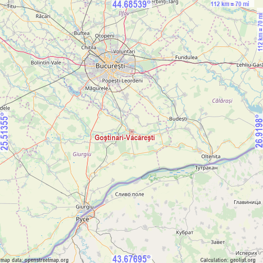
Goştinari-Văcăreşti GPS coordinates[2]
44° 10' 59.988" North, 26° 13' 0.012" East
| Map corner | latitude | longitude |
|---|---|---|
| Upper-left | 44.68539°, | 25.51355° |
| Center: | 44.18333°, | 26.21667° |
| Lower-right: | 43.67695°, | 26.9198° |
| Map W x H: | 112.1×112.1 km | = 69.7×69.7mi |
| max Lat: | 48.23793° ⇑93.8% North |
| Goştinari-Văcăreşti: | 44.18333° |
| min Lat: | ⇓6.2% South 43.65638° |
| min Long | Goştinari-Văc | max Long |
| 20.31667° | 26.21667° | 29.65403° |
| W 67.1%⇐ | ⇒32.9% E |
Elevation
Elevation of Goştinari-Văcăreşti is 39 m = 128 ft, and this is 215.9 m = 708 ft below average elevation for this country.
| Max E: |
1278 m = 4193 ft | 94% |
| Avg. | 254.9 m = 836 ft | |
| Goştinari-Văcăreşti | 39 m = 128 ft | |
Min E: |
-2 m = -7 ft | 6% |
See also: Romania elevation on elevation.city.
Geographical zone
Goştinari-Văcăreşti is located in North temperate zone (between Tropic of Cancer and the Arctic Circle). Distance of this Northern Tropic circle is 2306.8 km =1433.4 mi to South.| Distance of | km | miles | from Goştinari-Văcăreşti |
|---|---|---|---|
| North Pole | 5094.3 | 3165.5 | to North |
| Arctic Circle | 2488.4 | 1546.2 | to North |
| Tropic Cancer | 2306.8 | 1433.4 | to South |
| Equator | 4912.7 | 3052.6 | to South |


Nearby cities:
15 places around Goştinari-Văcăreşti: (largest is in red/bold)
• Budeni
8.1 km =5 mi,  276°
276°
• Colibaşi
2.7 km =1.7 mi,  320°
320°
• Comana
5.9 km =3.7 mi,  256°
256°
• Câmpurelu
6.1 km =3.8 mi,  337°
337°
• Dobreni
7.9 km =4.9 mi,  358°
358°
• Falaștoaca
2.7 km =1.7 mi,  288°
288°
• Gostinari
1 km =0.6 mi,  70°
70°
• Grădiștea
5.1 km =3.2 mi,  306°
306°
• Izvoarele
7.9 km =4.9 mi,  101°
101°
• Mironești
2.9 km =1.8 mi,  122°
122°
• Prundu
9.9 km =6.2 mi,  175°
175°
• Valea Dragului
7.6 km =4.7 mi, 65°
• Vidra
9.4 km =5.8 mi, 336°
• Vlad Țepeș
8.7 km =5.4 mi,  229°
229°
• Vărăşti
6.6 km =4.1 mi,  22°
22°
Sources, notices
• [Note1] Compared only with cities in Romania existing in our database
• [Src1] Map data: © OpenStreetMap contributors (CC-BY-SA)
• [Src2] Other city data from geonames.org with taken over terms of usage.
• [Src3] Geographical zone / Annual Mean Temperature by Robert A. Rohde @ Wikipedia
