Câmpu lui Neag geodata
Câmpu lui Neag (Hunedoara) is a populated place; located in Romania in Europe/Bucharest (GMT+3) time zone. With population of 582 people, there are 6342 cities with bigger population in this country. Compared to other cities in Romania, 58.8% of cities are located further ↑North; 83.9% of cities are located further →East and 98.1% of cities have lower elevation than Câmpu lui Neag. Note1


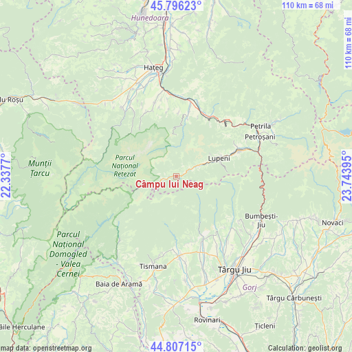
Câmpu lui Neag GPS coordinates[2]
45° 18' 13.86" North, 23° 2' 26.952" East
| Map corner | latitude | longitude |
|---|---|---|
| Upper-left | 45.79623°, | 22.3377° |
| Center: | 45.30385°, | 23.04082° |
| Lower-right: | 44.80715°, | 23.74395° |
| Map W x H: | 110×110 km | = 68.4×68.4mi |
| max Lat: | 48.23793° ⇑58.8% North |
| Câmpu lui Neag: | 45.30385° |
| min Lat: | ⇓41.2% South 43.65638° |
| min Long | Câmpu lui Neag | max Long |
| 20.31667° | 23.04082° | 29.65403° |
| W 16.1%⇐ | ⇒83.9% E |
Elevation
Elevation of Câmpu lui Neag is 776 m = 2546 ft, and this is 521.1 m = 1710 ft above average elevation for this country.
| Max E: |
1278 m = 4193 ft | 1.9% |
| Câmpu lui Neag | 776 m 2546 ft | |
| Avg. | 254.9 m = 836 ft | |
Min E: |
-2 m = -7 ft | 98.1% |
See also: Romania elevation on elevation.city.
Geographical zone
Câmpu lui Neag is located in North temperate zone (between Tropic of Cancer and the Arctic Circle). Distance of this North polar circle is 2363.9 km =1468.9 mi to North.| Distance of | km | miles | from Câmpu lui Neag |
|---|---|---|---|
| North Pole | 4969.7 | 3088 | to North |
| Arctic Circle | 2363.9 | 1468.9 | to North |
| Tropic Cancer | 2431.4 | 1510.8 | to South |
| Equator | 5037.3 | 3130 | to South |


Nearby cities:
15 places around Câmpu lui Neag: (largest is in red/bold)
• Baru
21 km =13 mi,  26°
26°
• Baru Mic
20 km =12.4 mi, 25°
• Bâlta
21.2 km =13.2 mi,  166°
166°
• Dobrița
21.5 km =13.4 mi,  150°
150°
• Gureni
21.3 km =13.2 mi,  180°
180°
• Jiu-Paroșeni
18.3 km =11.4 mi,  69°
69°
• Livadia
22.3 km =13.9 mi,  18°
18°
• Lupeni
16.7 km =10.4 mi, 67°
• Petros
22.4 km =13.9 mi, 30°
• Runcu
22 km =13.7 mi,  160°
160°
• Uricani
9.5 km =5.9 mi, 66°
• Valea Mare
21.5 km =13.4 mi, 171°
• Valea de Brazi
3.6 km =2.2 mi,  64°
64°
• Vulcan
19.7 km =12.2 mi, 63°
• Șerel
20 km =12.4 mi,  2°
2°
Sources, notices
• [Note1] Compared only with cities in Romania existing in our database
• [Src1] Map data: © OpenStreetMap contributors (CC-BY-SA)
• [Src2] Other city data from geonames.org with taken over terms of usage.
• [Src3] Geographical zone / Annual Mean Temperature by Robert A. Rohde @ Wikipedia
