Baru geodata
Baru (Hunedoara) is a seat of a second-order administrative division; located in Romania in Europe/Bucharest (GMT+3) time zone. With population of 1,333 people, there are 3457 cities with bigger population in this country. Compared to other cities in Romania, 55.8% of cities are located further ↑North; 82.1% of cities are located further →East and 87.3% of cities have lower elevation than Baru. Note1


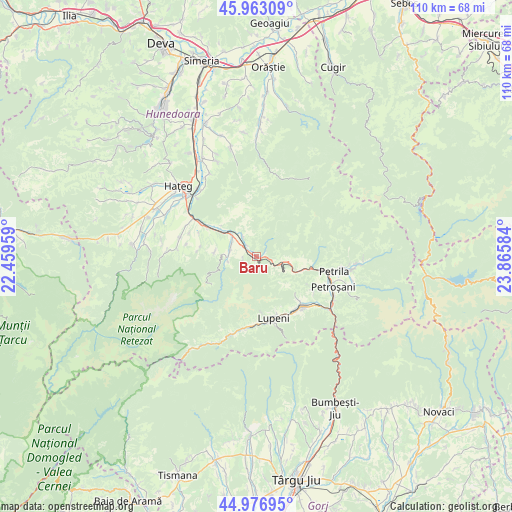
Baru GPS coordinates[2]
45° 28' 19.848" North, 23° 9' 45.756" East
| Map corner | latitude | longitude |
|---|---|---|
| Upper-left | 45.96309°, | 22.45959° |
| Center: | 45.47218°, | 23.16271° |
| Lower-right: | 44.97695°, | 23.86584° |
| Map W x H: | 109.6×109.6 km | = 68.1×68.1mi |
| max Lat: | 48.23793° ⇑55.8% North |
| Baru: | 45.47218° |
| min Lat: | ⇓44.2% South 43.65638° |
| min Long | Baru | max Long |
| 20.31667° | 23.16271° | 29.65403° |
| W 17.9%⇐ | ⇒82.1% E |
Elevation
Elevation of Baru is 474 m = 1555 ft, and this is 219.1 m = 719 ft above average elevation for this country.
| Max E: |
1278 m = 4193 ft | 12.7% |
| Baru | 474 m 1555 ft | |
| Avg. | 254.9 m = 836 ft | |
Min E: |
-2 m = -7 ft | 87.3% |
See also: Romania elevation on elevation.city.
Geographical zone
Baru is located in North temperate zone (between Tropic of Cancer and the Arctic Circle). Distance of this North polar circle is 2345.1 km =1457.2 mi to North.| Distance of | km | miles | from Baru |
|---|---|---|---|
| North Pole | 4951 | 3076.4 | to North |
| Arctic Circle | 2345.1 | 1457.2 | to North |
| Tropic Cancer | 2450.1 | 1522.4 | to South |
| Equator | 5056 | 3141.7 | to South |


Nearby cities:
15 places around Baru: (largest is in red/bold)
• Aninoasa
13.8 km =8.6 mi,  120°
120°
• Baru Mic
1.2 km =0.7 mi,  238°
238°
• Băniţa
8.5 km =5.3 mi,  106°
106°
• Fizești
9.8 km =6.1 mi,  322°
322°
• Iscroni
17.5 km =10.9 mi,  126°
126°
• Jiu-Paroșeni
14.5 km =9 mi,  148°
148°
• Livadia
3.5 km =2.2 mi, 315°
• Lupeni
13.8 km =8.6 mi, 154°
• Petros
1.9 km =1.2 mi,  69°
69°
• Petroşani
17.1 km =10.6 mi, 111°
• Pui
7 km =4.3 mi, 315°
• Sălaşu de Sus
17.3 km =10.7 mi,  286°
286°
• Uricani
15 km =9.3 mi,  183°
183°
• Vulcan
12.8 km =8 mi,  140°
140°
• Șerel
8.7 km =5.4 mi,  278°
278°
Sources, notices
• [Note1] Compared only with cities in Romania existing in our database
• [Src1] Map data: © OpenStreetMap contributors (CC-BY-SA)
• [Src2] Other city data from geonames.org with taken over terms of usage.
• [Src3] Geographical zone / Annual Mean Temperature by Robert A. Rohde @ Wikipedia
