Chirpăr geodata
Chirpăr (Sibiu) is a seat of a second-order administrative division; located in Romania in Europe/Bucharest (GMT+3) time zone. With population of 1,448 people, there are 3259 cities with bigger population in this country. Compared to other cities in Romania, 52.6% of cities are located further ↓South; 58.9% of cities are located further →East and 85.2% of cities have lower elevation than Chirpăr. Note1


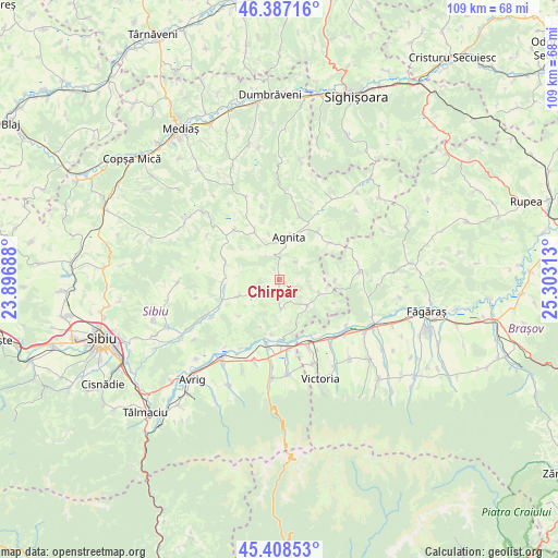
Chirpăr GPS coordinates[2]
45° 54' 0" North, 24° 36' 0" East
| Map corner | latitude | longitude |
|---|---|---|
| Upper-left | 46.38716°, | 23.89688° |
| Center: | 45.9°, | 24.6° |
| Lower-right: | 45.40853°, | 25.30313° |
| Map W x H: | 108.8×108.8 km | = 67.6×67.6mi |
| max Lat: | 48.23793° ⇑47.4% North |
| Chirpăr: | 45.9° |
| min Lat: | ⇓52.6% South 43.65638° |
| min Long | Chirpăr | max Long |
| 20.31667° | 24.6° | 29.65403° |
| W 41.1%⇐ | ⇒58.9% E |
Elevation
Elevation of Chirpăr is 448 m = 1470 ft, and this is 193.1 m = 634 ft above average elevation for this country.
| Max E: |
1278 m = 4193 ft | 14.8% |
| Chirpăr | 448 m 1470 ft | |
| Avg. | 254.9 m = 836 ft | |
Min E: |
-2 m = -7 ft | 85.2% |
See also: Romania elevation on elevation.city.
Geographical zone
Chirpăr is located in North temperate zone (between Tropic of Cancer and the Arctic Circle). Distance of this North polar circle is 2297.6 km =1427.7 mi to North.| Distance of | km | miles | from Chirpăr |
|---|---|---|---|
| North Pole | 4903.5 | 3046.9 | to North |
| Arctic Circle | 2297.6 | 1427.7 | to North |
| Tropic Cancer | 2497.7 | 1552 | to South |
| Equator | 5103.6 | 3171.2 | to South |


Nearby cities:
15 places around Chirpăr: (largest is in red/bold)
• Agnita
7.5 km =4.7 mi,  9°
9°
• Alțâna
11 km =6.8 mi,  289°
289°
• Arpaşu de Jos
13 km =8.1 mi,  174°
174°
• Bruiu
8.6 km =5.3 mi,  115°
115°
• Bârghiş
10.6 km =6.6 mi,  330°
330°
• Coveș
9.2 km =5.7 mi,  346°
346°
• Cârţa
13.2 km =8.2 mi,  191°
191°
• Dealu Frumos
12.1 km =7.5 mi,  38°
38°
• Hosman
15.1 km =9.4 mi,  240°
240°
• Marpod
8.6 km =5.3 mi, 244°
• Merghindeal
12.7 km =7.9 mi,  54°
54°
• Nocrich
11.6 km =7.2 mi,  270°
270°
• Ruja
13 km =8.1 mi,  17°
17°
• Ucea de Jos
14 km =8.7 mi,  156°
156°
• Viștea de Jos
15 km =9.3 mi,  140°
140°
Sources, notices
• [Note1] Compared only with cities in Romania existing in our database
• [Src1] Map data: © OpenStreetMap contributors (CC-BY-SA)
• [Src2] Other city data from geonames.org with taken over terms of usage.
• [Src3] Geographical zone / Annual Mean Temperature by Robert A. Rohde @ Wikipedia
