Căpățânenii Ungureni geodata
Căpățânenii Ungureni (Arges) is a populated place; located in Romania in Europe/Bucharest (GMT+3) time zone. With population of 528 people, there are 6791 cities with bigger population in this country. Compared to other cities in Romania, 58.2% of cities are located further ↑North; 58.4% of cities are located further →East and 95.2% of cities have lower elevation than Căpățânenii Ungureni. Note1


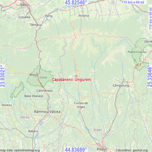
Căpățânenii Ungureni GPS coordinates[2]
45° 19' 59.988" North, 24° 37' 59.988" East
| Map corner | latitude | longitude |
|---|---|---|
| Upper-left | 45.82546°, | 23.93021° |
| Center: | 45.33333°, | 24.63333° |
| Lower-right: | 44.83689°, | 25.33646° |
| Map W x H: | 109.9×109.9 km | = 68.3×68.3mi |
| max Lat: | 48.23793° ⇑58.2% North |
| Căpățânenii Ungureni: | 45.33333° |
| min Lat: | ⇓41.8% South 43.65638° |
| min Long | Căpățânenii | max Long |
| 20.31667° | 24.63333° | 29.65403° |
| W 41.6%⇐ | ⇒58.4% E |
Elevation
Elevation of Căpățânenii Ungureni is 633 m = 2077 ft, and this is 378.1 m = 1240 ft above average elevation for this country.
| Max E: |
1278 m = 4193 ft | 4.8% |
| Căpățânenii Ungureni | 633 m 2077 ft | |
| Avg. | 254.9 m = 836 ft | |
Min E: |
-2 m = -7 ft | 95.2% |
See also: Romania elevation on elevation.city.
Geographical zone
Căpățânenii Ungureni is located in North temperate zone (between Tropic of Cancer and the Arctic Circle). Distance of this North polar circle is 2360.6 km =1466.8 mi to North.| Distance of | km | miles | from Căpățânenii Ungureni |
|---|---|---|---|
| North Pole | 4966.5 | 3086 | to North |
| Arctic Circle | 2360.6 | 1466.8 | to North |
| Tropic Cancer | 2434.7 | 1512.9 | to South |
| Equator | 5040.6 | 3132.1 | to South |


Nearby cities:
15 places around Căpățânenii Ungureni: (largest is in red/bold)
• Arefu
2.6 km =1.6 mi,  270°
270°
• Brădetu
10.4 km =6.5 mi,  104°
104°
• Bucșenești
4.1 km =2.5 mi,  151°
151°
• Bărăști
9.3 km =5.8 mi,  198°
198°
• Cicănești
10 km =6.2 mi,  192°
192°
• Corbeni
3.9 km =2.4 mi,  160°
160°
• Căpățânenii Pământeni
2.3 km =1.4 mi,  144°
144°
• Nucşoara
11.7 km =7.3 mi,  90°
90°
• Oeștii Pământeni
9.2 km =5.7 mi,  168°
168°
• Oeștii Ungureni
9 km =5.6 mi, 172°
• Poienari
2.3 km =1.4 mi, 144°
• Rotunda
5.2 km =3.2 mi, 160°
• Sălătrucu
9.1 km =5.7 mi, 270°
• Urechești
8.3 km =5.2 mi, 189°
• Văleni
10.8 km =6.7 mi,  224°
224°
Sources, notices
• [Note1] Compared only with cities in Romania existing in our database
• [Src1] Map data: © OpenStreetMap contributors (CC-BY-SA)
• [Src2] Other city data from geonames.org with taken over terms of usage.
• [Src3] Geographical zone / Annual Mean Temperature by Robert A. Rohde @ Wikipedia
