Balinţ geodata
Balinţ (Timiş) is a seat of a second-order administrative division; located in Romania in Europe/Bucharest (GMT+3) time zone. With population of 1,736 people, there are 2889 cities with bigger population in this country. Compared to other cities in Romania, 50.6% of cities are located further ↓South; 95.4% of cities are located further →East and 72.7% of cities have higher elevation than Balinţ. Note1


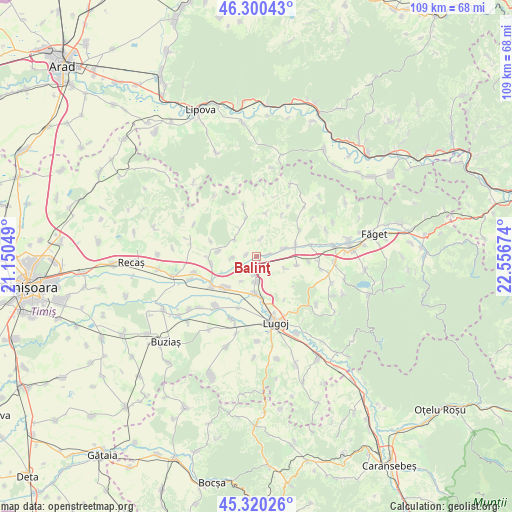
Balinţ GPS coordinates[2]
45° 48' 45" North, 21° 51' 12.996" East
| Map corner | latitude | longitude |
|---|---|---|
| Upper-left | 46.30043°, | 21.15049° |
| Center: | 45.8125°, | 21.85361° |
| Lower-right: | 45.32026°, | 22.55674° |
| Map W x H: | 109×109 km | = 67.7×67.7mi |
| max Lat: | 48.23793° ⇑49.4% North |
| Balinţ: | 45.8125° |
| min Lat: | ⇓50.6% South 43.65638° |
| min Long | Balinţ | max Long |
| 20.31667° | 21.85361° | 29.65403° |
| W 4.6%⇐ | ⇒95.4% E |
Elevation
Elevation of Balinţ is 118 m = 387 ft, and this is 136.9 m = 449 ft below average elevation for this country.
| Max E: |
1278 m = 4193 ft | 72.7% |
| Avg. | 254.9 m = 836 ft | |
| Balinţ | 118 m = 387 ft | |
Min E: |
-2 m = -7 ft | 27.3% |
See also: Romania elevation on elevation.city.
Geographical zone
Balinţ is located in North temperate zone (between Tropic of Cancer and the Arctic Circle). Distance of this North polar circle is 2307.3 km =1433.7 mi to North.| Distance of | km | miles | from Balinţ |
|---|---|---|---|
| North Pole | 4913.2 | 3052.9 | to North |
| Arctic Circle | 2307.3 | 1433.7 | to North |
| Tropic Cancer | 2488 | 1546 | to South |
| Equator | 5093.9 | 3165.2 | to South |


Nearby cities:
15 places around Balinţ: (largest is in red/bold)
• Bara
9.3 km =5.8 mi,  8°
8°
• Belinţ
9.7 km =6 mi,  228°
228°
• Bethausen
8 km =5 mi,  73°
73°
• Bodo
2.4 km =1.5 mi,  81°
81°
• Chizătău
11.4 km =7.1 mi,  235°
235°
• Cladova
10.8 km =6.7 mi,  57°
57°
• Coşteiu
7.9 km =4.9 mi,  182°
182°
• Ghizela
9.1 km =5.7 mi,  278°
278°
• Iosifalău
13.8 km =8.6 mi,  255°
255°
• Jupani
12.9 km =8 mi,  93°
93°
• Leucușești
12 km =7.5 mi, 77°
• Lugoj
14.3 km =8.9 mi,  164°
164°
• Ohaba-Forgaci
13.6 km =8.5 mi,  219°
219°
• Secaş
8.5 km =5.3 mi,  341°
341°
• Șanovița
9.7 km =6 mi, 260°
Sources, notices
• [Note1] Compared only with cities in Romania existing in our database
• [Src1] Map data: © OpenStreetMap contributors (CC-BY-SA)
• [Src2] Other city data from geonames.org with taken over terms of usage.
• [Src3] Geographical zone / Annual Mean Temperature by Robert A. Rohde @ Wikipedia
