Beliş geodata
Beliş (Cluj) is a seat of a second-order administrative division; located in Romania in Europe/Bucharest (GMT+3) time zone. With population of 1,377 people, there are 3381 cities with bigger population in this country. Compared to other cities in Romania, 70.5% of cities are located further ↓South; 84% of cities are located further →East and 99.9% of cities have lower elevation than Beliş. Note1


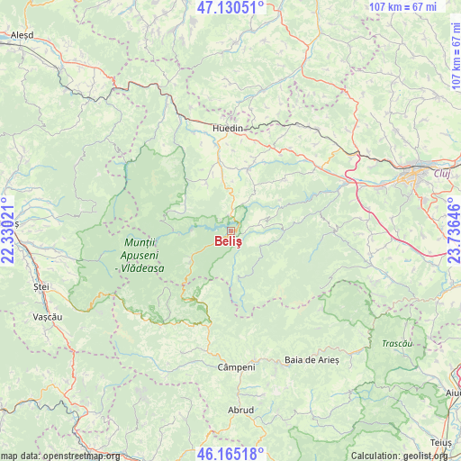
Beliş GPS coordinates[2]
46° 39' 0" North, 23° 1' 59.988" East
| Map corner | latitude | longitude |
|---|---|---|
| Upper-left | 47.13051°, | 22.33021° |
| Center: | 46.65°, | 23.03333° |
| Lower-right: | 46.16518°, | 23.73646° |
| Map W x H: | 107.3×107.3 km | = 66.7×66.7mi |
| max Lat: | 48.23793° ⇑29.5% North |
| Beliş: | 46.65° |
| min Lat: | ⇓70.5% South 43.65638° |
| min Long | Beliş | max Long |
| 20.31667° | 23.03333° | 29.65403° |
| W 16%⇐ | ⇒84% E |
Elevation
Elevation of Beliş is 1103 m = 3619 ft, and this is 848.1 m = 2782 ft above average elevation for this country.
| Max E: |
1278 m = 4193 ft | 0.099999999999994% |
| Beliş | 1103 m 3619 ft | |
| Avg. | 254.9 m = 836 ft | |
Min E: |
-2 m = -7 ft | 99.9% |
See also: Romania elevation on elevation.city.
Geographical zone
Beliş is located in North temperate zone (between Tropic of Cancer and the Arctic Circle). Distance of this North polar circle is 2214.2 km =1375.8 mi to North.| Distance of | km | miles | from Beliş |
|---|---|---|---|
| North Pole | 4820.1 | 2995.1 | to North |
| Arctic Circle | 2214.2 | 1375.8 | to North |
| Tropic Cancer | 2581.1 | 1603.8 | to South |
| Equator | 5187 | 3223.1 | to South |


Nearby cities:
15 places around Beliş: (largest is in red/bold)
• Bedeciu
17.8 km =11.1 mi,  25°
25°
• Bogdăneşti
7.9 km =4.9 mi,  103°
103°
• Călăţele
13 km =8.1 mi,  354°
354°
• Dealu Negru
7.3 km =4.5 mi,  20°
20°
• Horea
17.6 km =10.9 mi,  201°
201°
• Muntele Rece
19.2 km =11.9 mi,  91°
91°
• Mânăstireni
13.5 km =8.4 mi, 16°
• Măguri
5.8 km =3.6 mi,  114°
114°
• Măguri-Răcătău
12.5 km =7.8 mi, 92°
• Mărgău
12.2 km =7.6 mi,  335°
335°
• Mărişel
7.6 km =4.7 mi, 90°
• Rogojel
20.7 km =12.9 mi,  320°
320°
• Râșca
11.4 km =7.1 mi, 29°
• Răchițele
12.3 km =7.6 mi,  300°
300°
• Sâncraiu
20.7 km =12.9 mi, 349°
Sources, notices
• [Note1] Compared only with cities in Romania existing in our database
• [Src1] Map data: © OpenStreetMap contributors (CC-BY-SA)
• [Src2] Other city data from geonames.org with taken over terms of usage.
• [Src3] Geographical zone / Annual Mean Temperature by Robert A. Rohde @ Wikipedia
