Balda geodata
Balda (Mureş) is a populated place; located in Romania in Europe/Bucharest (GMT+3) time zone. With population of 1,171 people, there are 3799 cities with bigger population in this country. Compared to other cities in Romania, 72.5% of cities are located further ↓South; 67% of cities are located further →East and 71.7% of cities have lower elevation than Balda. Note1


Balda GPS coordinates[2]
46° 44' 0.708" North, 24° 8' 37.032" East
| Map corner | latitude | longitude |
|---|---|---|
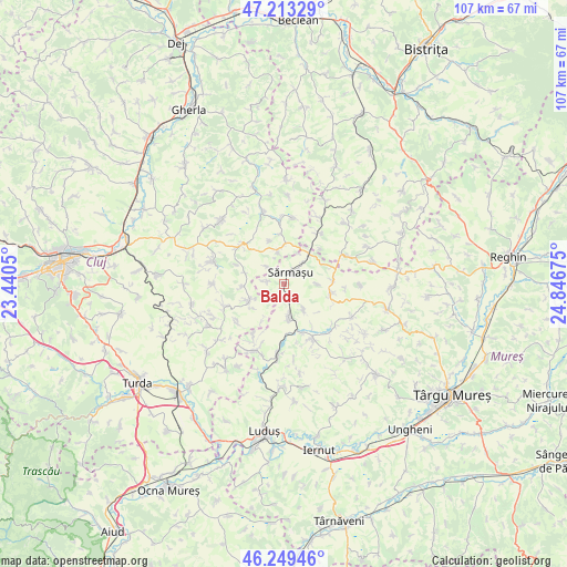
| Upper-left | 47.21329°, | 23.4405° |
| Center: | 46.73353°, | 24.14362° |
| Lower-right: | 46.24946°, | 24.84675° |
| Map W x H: | 107.2×107.2 km | = 66.6×66.6mi |
| max Lat: | 48.23793° ⇑27.5% North |
| Balda: | 46.73353° |
| min Lat: | ⇓72.5% South 43.65638° |
| min Long | Balda | max Long |
| 20.31667° | 24.14362° | 29.65403° |
| W 33%⇐ | ⇒67% E |
Elevation
Elevation of Balda is 332 m = 1089 ft, and this is 77.1 m = 253 ft above average elevation for this country.
| Max E: |
1278 m = 4193 ft | 28.3% |
| Balda | 332 m 1089 ft | |
| Avg. | 254.9 m = 836 ft | |
Min E: |
-2 m = -7 ft | 71.7% |
See also: Romania elevation on elevation.city.
Geographical zone
Balda is located in North temperate zone (between Tropic of Cancer and the Arctic Circle). Distance of this North polar circle is 2204.9 km =1370.1 mi to North.| Distance of | km | miles | from Balda |
|---|---|---|---|
| North Pole | 4810.8 | 2989.3 | to North |
| Arctic Circle | 2204.9 | 1370.1 | to North |
| Tropic Cancer | 2590.4 | 1609.6 | to South |
| Equator | 5196.3 | 3228.8 | to South |


Nearby cities:
15 places around Balda: (largest is in red/bold)
• Berchieșu
8.1 km =5 mi,  265°
265°
• Cămăraşu
5.6 km =3.5 mi,  351°
351°
• Dâmbu
9.6 km =6 mi,  83°
83°
• Frata
8.1 km =5 mi,  242°
242°
• Iacobeni
11.2 km =7 mi,  231°
231°
• Miheşu de Câmpie
5.6 km =3.5 mi,  175°
175°
• Năoiu
4.6 km =2.9 mi,  316°
316°
• Răzoare
6 km =3.7 mi,  140°
140°
• Sâmboleni
8.6 km =5.3 mi,  341°
341°
• Sânpetru de Câmpie
9.3 km =5.8 mi,  102°
102°
• Sărmaşu
2.5 km =1.6 mi,  43°
43°
• Sărmășel
4 km =2.5 mi, 41°
• Sărmășel-Gară
7.5 km =4.7 mi, 39°
• Tușinu
6.4 km =4 mi,  90°
90°
• Vișinelu
3.2 km =2 mi,  278°
278°
Sources, notices
• [Note1] Compared only with cities in Romania existing in our database
• [Src1] Map data: © OpenStreetMap contributors (CC-BY-SA)
• [Src2] Other city data from geonames.org with taken over terms of usage.
• [Src3] Geographical zone / Annual Mean Temperature by Robert A. Rohde @ Wikipedia
