Frata geodata
Frata (Cluj) is a seat of a second-order administrative division; located in Romania in Europe/Bucharest (GMT+3) time zone. With population of 4,323 people, there are 1041 cities with bigger population in this country. Compared to other cities in Romania, 71.7% of cities are located further ↓South; 68.6% of cities are located further →East and 81% of cities have lower elevation than Frata. Note1


Frata GPS coordinates[2]
46° 42' 0" North, 24° 3' 0" East
| Map corner | latitude | longitude |
|---|---|---|
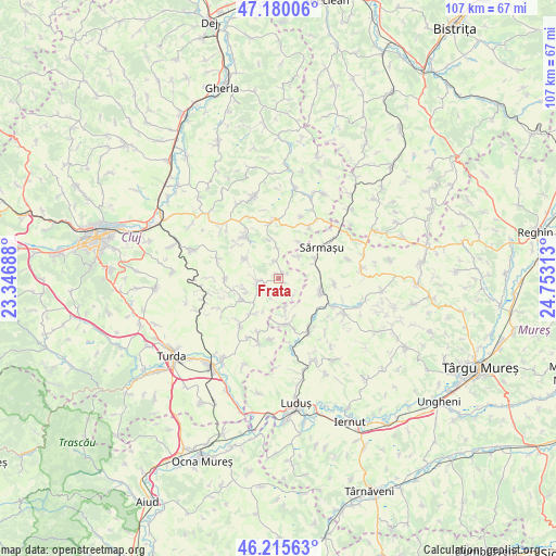
| Upper-left | 47.18006°, | 23.34688° |
| Center: | 46.7°, | 24.05° |
| Lower-right: | 46.21563°, | 24.75313° |
| Map W x H: | 107.2×107.2 km | = 66.6×66.6mi |
| max Lat: | 48.23793° ⇑28.3% North |
| Frata: | 46.7° |
| min Lat: | ⇓71.7% South 43.65638° |
| min Long | Frata | max Long |
| 20.31667° | 24.05° | 29.65403° |
| W 31.4%⇐ | ⇒68.6% E |
Elevation
Elevation of Frata is 403 m = 1322 ft, and this is 148.1 m = 486 ft above average elevation for this country.
| Max E: |
1278 m = 4193 ft | 19% |
| Frata | 403 m 1322 ft | |
| Avg. | 254.9 m = 836 ft | |
Min E: |
-2 m = -7 ft | 81% |
See also: Romania elevation on elevation.city.
Geographical zone
Frata is located in North temperate zone (between Tropic of Cancer and the Arctic Circle). Distance of this North polar circle is 2208.6 km =1372.4 mi to North.| Distance of | km | miles | from Frata |
|---|---|---|---|
| North Pole | 4814.5 | 2991.6 | to North |
| Arctic Circle | 2208.6 | 1372.4 | to North |
| Tropic Cancer | 2586.6 | 1607.2 | to South |
| Equator | 5192.6 | 3226.5 | to South |


Nearby cities:
15 places around Frata: (largest is in red/bold)
• Balda
8.1 km =5 mi,  62°
62°
• Berchieșu
3.3 km =2.1 mi,  343°
343°
• Boian
8.3 km =5.2 mi,  212°
212°
• Ceanu Mare
8.5 km =5.3 mi,  244°
244°
• Cămăraşu
11.2 km =7 mi,  34°
34°
• Iacobeni
3.7 km =2.3 mi, 205°
• Miheşu de Câmpie
7.8 km =4.8 mi,  103°
103°
• Năoiu
8.1 km =5 mi, 29°
• Poduri
9.4 km =5.8 mi,  172°
172°
• Răzoare
11 km =6.8 mi,  94°
94°
• Soporu de Câmpie
3.3 km =2.1 mi,  262°
262°
• Suatu
9.8 km =6.1 mi,  319°
319°
• Sărmaşu
10.5 km =6.5 mi, 57°
• Valea Largă
8.9 km =5.5 mi, 166°
• Vișinelu
5.8 km =3.6 mi,  43°
43°
Sources, notices
• [Note1] Compared only with cities in Romania existing in our database
• [Src1] Map data: © OpenStreetMap contributors (CC-BY-SA)
• [Src2] Other city data from geonames.org with taken over terms of usage.
• [Src3] Geographical zone / Annual Mean Temperature by Robert A. Rohde @ Wikipedia
