Bălăceana geodata
Bălăceana (Suceava) is a seat of a second-order administrative division; located in Romania in Europe/Bucharest (GMT+3) time zone. With population of 1,720 people, there are 2904 cities with bigger population in this country. Compared to other cities in Romania, 93.9% of cities are located further ↓South; 63.9% of cities are located further ←West and 75.7% of cities have lower elevation than Bălăceana. Note1


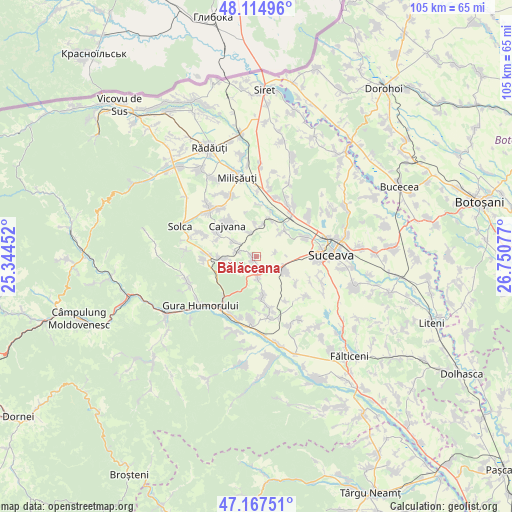
Bălăceana GPS coordinates[2]
47° 38' 36.168" North, 26° 2' 51.504" East
| Map corner | latitude | longitude |
|---|---|---|
| Upper-left | 48.11496°, | 25.34452° |
| Center: | 47.64338°, | 26.04764° |
| Lower-right: | 47.16751°, | 26.75077° |
| Map W x H: | 105.3×105.3 km | = 65.4×65.4mi |
| max Lat: | 48.23793° ⇑6.1% North |
| Bălăceana: | 47.64338° |
| min Lat: | ⇓93.9% South 43.65638° |
| min Long | Bălăceana | max Long |
| 20.31667° | 26.04764° | 29.65403° |
| W 63.9%⇐ | ⇒36.1% E |
Elevation
Elevation of Bălăceana is 359 m = 1178 ft, and this is 104.1 m = 342 ft above average elevation for this country.
| Max E: |
1278 m = 4193 ft | 24.3% |
| Bălăceana | 359 m 1178 ft | |
| Avg. | 254.9 m = 836 ft | |
Min E: |
-2 m = -7 ft | 75.7% |
See also: Romania elevation on elevation.city.
Geographical zone
Bălăceana is located in North temperate zone (between Tropic of Cancer and the Arctic Circle). Distance of this North polar circle is 2103.7 km =1307.2 mi to North.| Distance of | km | miles | from Bălăceana |
|---|---|---|---|
| North Pole | 4709.6 | 2926.4 | to North |
| Arctic Circle | 2103.7 | 1307.2 | to North |
| Tropic Cancer | 2691.5 | 1672.4 | to South |
| Equator | 5297.4 | 3291.7 | to South |


Nearby cities:
15 places around Bălăceana: (largest is in red/bold)
• Botoşana
8.6 km =5.3 mi,  301°
301°
• Cajvana
8.7 km =5.4 mi,  316°
316°
• Ciprian Porumbescu
8.6 km =5.3 mi,  170°
170°
• Comănești
5.3 km =3.3 mi, 303°
• Costâna
7.7 km =4.8 mi,  44°
44°
• Deleni
5.7 km =3.5 mi,  254°
254°
• Drăgoiești
10.7 km =6.6 mi, 165°
• Humoreni
5.5 km =3.4 mi, 298°
• Ilișești
3.9 km =2.4 mi,  176°
176°
• Părhăuți
8.1 km =5 mi,  23°
23°
• Părteştii de Jos
6.2 km =3.9 mi,  259°
259°
• Soloneț
5 km =3.1 mi,  346°
346°
• Stroiești
7.1 km =4.4 mi,  114°
114°
• Todireşti
6.4 km =4 mi, 350°
• Zaharești
9.8 km =6.1 mi,  126°
126°
Sources, notices
• [Note1] Compared only with cities in Romania existing in our database
• [Src1] Map data: © OpenStreetMap contributors (CC-BY-SA)
• [Src2] Other city data from geonames.org with taken over terms of usage.
• [Src3] Geographical zone / Annual Mean Temperature by Robert A. Rohde @ Wikipedia
