Andrieşeni geodata
Andrieşeni (Iaşi) is a seat of a second-order administrative division; located in Romania in Europe/Bucharest (GMT+3) time zone. With population of 4,501 people, there are 950 cities with bigger population in this country. Compared to other cities in Romania, 91.5% of cities are located further ↓South; 88% of cities are located further ←West and 89.5% of cities have higher elevation than Andrieşeni. Note1


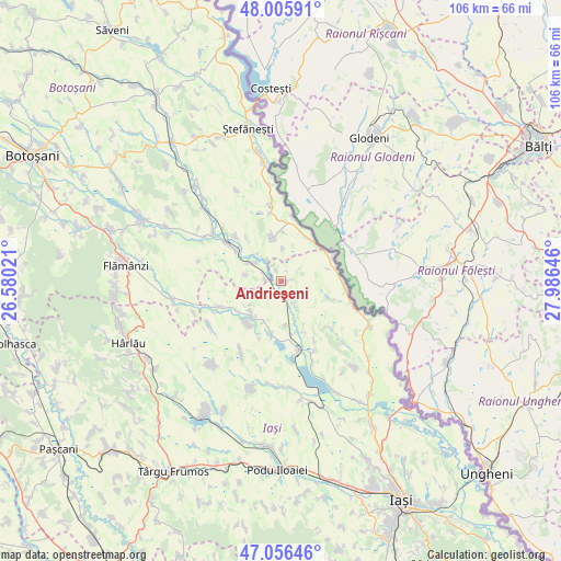
Andrieşeni GPS coordinates[2]
47° 31' 59.988" North, 27° 16' 59.988" East
| Map corner | latitude | longitude |
|---|---|---|
| Upper-left | 48.00591°, | 26.58021° |
| Center: | 47.53333°, | 27.28333° |
| Lower-right: | 47.05646°, | 27.98646° |
| Map W x H: | 105.6×105.6 km | = 65.6×65.6mi |
| max Lat: | 48.23793° ⇑8.5% North |
| Andrieşeni: | 47.53333° |
| min Lat: | ⇓91.5% South 43.65638° |
| min Long | Andrieşeni | max Long |
| 20.31667° | 27.28333° | 29.65403° |
| W 88%⇐ | ⇒12% E |
Elevation
Elevation of Andrieşeni is 60 m = 197 ft, and this is 194.9 m = 639 ft below average elevation for this country.
| Max E: |
1278 m = 4193 ft | 89.5% |
| Avg. | 254.9 m = 836 ft | |
| Andrieşeni | 60 m = 197 ft | |
Min E: |
-2 m = -7 ft | 10.5% |
See also: Romania elevation on elevation.city.
Geographical zone
Andrieşeni is located in North temperate zone (between Tropic of Cancer and the Arctic Circle). Distance of this North polar circle is 2116 km =1314.8 mi to North.| Distance of | km | miles | from Andrieşeni |
|---|---|---|---|
| North Pole | 4721.9 | 2934.1 | to North |
| Arctic Circle | 2116 | 1314.8 | to North |
| Tropic Cancer | 2679.3 | 1664.8 | to South |
| Equator | 5285.2 | 3284.1 | to South |


Nearby cities:
15 places around Andrieşeni: (largest is in red/bold)
• Alexandru cel Bun
8.4 km =5.2 mi,  173°
173°
• Chișcăreni
9.6 km =6 mi,  222°
222°
• Călăraşi
9.4 km =5.8 mi,  352°
352°
• Doina
6.6 km =4.1 mi,  278°
278°
• Glăvănești
2.4 km =1.5 mi,  335°
335°
• Hălceni
10.3 km =6.4 mi,  188°
188°
• Iazu Nou
7.9 km =4.9 mi, 224°
• Libertatea
9.3 km =5.8 mi,  1°
1°
• Pleșani
6.1 km =3.8 mi, 2°
• Rediu
3.3 km =2.1 mi,  285°
285°
• Răuseni
7.3 km =4.5 mi,  300°
300°
• Santa Mare
10.5 km =6.5 mi,  28°
28°
• Spineni
5.6 km =3.5 mi,  151°
151°
• Tabăra
10.7 km =6.6 mi,  64°
64°
• Şipote
8.9 km =5.5 mi,  214°
214°
Sources, notices
• [Note1] Compared only with cities in Romania existing in our database
• [Src1] Map data: © OpenStreetMap contributors (CC-BY-SA)
• [Src2] Other city data from geonames.org with taken over terms of usage.
• [Src3] Geographical zone / Annual Mean Temperature by Robert A. Rohde @ Wikipedia
