Călăraşi geodata
Călăraşi (Botoşani) is a seat of a second-order administrative division; located in Romania in Europe/Bucharest (GMT+3) time zone. With population of 3,962 people, there are 1179 cities with bigger population in this country. Compared to other cities in Romania, 93.3% of cities are located further ↓South; 87.8% of cities are located further ←West and 57.4% of cities have higher elevation than Călăraşi. Note1


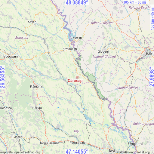
Călăraşi GPS coordinates[2]
47° 37' 0.012" North, 27° 16' 0.012" East
| Map corner | latitude | longitude |
|---|---|---|
| Upper-left | 48.08849°, | 26.56355° |
| Center: | 47.61667°, | 27.26667° |
| Lower-right: | 47.14055°, | 27.9698° |
| Map W x H: | 105.4×105.4 km | = 65.5×65.5mi |
| max Lat: | 48.23793° ⇑6.7% North |
| Călăraşi: | 47.61667° |
| min Lat: | ⇓93.3% South 43.65638° |
| min Long | Călăraşi | max Long |
| 20.31667° | 27.26667° | 29.65403° |
| W 87.8%⇐ | ⇒12.2% E |
Elevation
Elevation of Călăraşi is 176 m = 577 ft, and this is 78.9 m = 259 ft below average elevation for this country.
| Max E: |
1278 m = 4193 ft | 57.4% |
| Avg. | 254.9 m = 836 ft | |
| Călăraşi | 176 m = 577 ft | |
Min E: |
-2 m = -7 ft | 42.6% |
See also: Romania elevation on elevation.city.
Geographical zone
Călăraşi is located in North temperate zone (between Tropic of Cancer and the Arctic Circle). Distance of this North polar circle is 2106.7 km =1309 mi to North.| Distance of | km | miles | from Călăraşi |
|---|---|---|---|
| North Pole | 4712.6 | 2928.3 | to North |
| Arctic Circle | 2106.7 | 1309 | to North |
| Tropic Cancer | 2688.6 | 1670.6 | to South |
| Equator | 5294.5 | 3289.8 | to South |


Nearby cities:
15 places around Călăraşi: (largest is in red/bold)
• Andrieşeni
9.4 km =5.8 mi,  172°
172°
• Cernești
12.8 km =8 mi,  266°
266°
• Doina
9.8 km =6.1 mi,  212°
212°
• Dămideni
8.9 km =5.5 mi,  353°
353°
• Glăvănești
7.1 km =4.4 mi,  177°
177°
• Hlipiceni
8.9 km =5.5 mi,  258°
258°
• Libertatea
1.6 km =1 mi,  89°
89°
• Pleșani
3.5 km =2.2 mi,  154°
154°
• Rediu
8.6 km =5.3 mi,  192°
192°
• Răuseni
7.5 km =4.7 mi,  221°
221°
• Santa Mare
6.2 km =3.9 mi, 90°
• Tabăra
11.9 km =7.4 mi,  113°
113°
• Todireni
11.2 km =7 mi, 270°
• Tudor Vladimirescu
10.5 km =6.5 mi,  317°
317°
• Victoria
7.5 km =4.7 mi, 264°
Sources, notices
• [Note1] Compared only with cities in Romania existing in our database
• [Src1] Map data: © OpenStreetMap contributors (CC-BY-SA)
• [Src2] Other city data from geonames.org with taken over terms of usage.
• [Src3] Geographical zone / Annual Mean Temperature by Robert A. Rohde @ Wikipedia
