Amărăşti geodata
Amărăşti (Vâlcea) is a seat of a second-order administrative division; located in Romania in Europe/Bucharest (GMT+3) time zone. With population of 2,109 people, there are 2505 cities with bigger population in this country. Compared to other cities in Romania, 77.9% of cities are located further ↑North; 67% of cities are located further →East and 50.8% of cities have lower elevation than Amărăşti. Note1


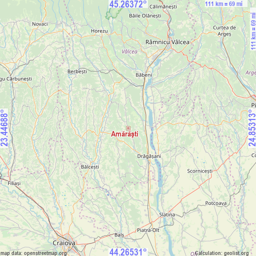
Amărăşti GPS coordinates[2]
44° 46' 0.012" North, 24° 9' 0" East
| Map corner | latitude | longitude |
|---|---|---|
| Upper-left | 45.26372°, | 23.44688° |
| Center: | 44.76667°, | 24.15° |
| Lower-right: | 44.26531°, | 24.85313° |
| Map W x H: | 111×111 km | = 69×69mi |
| max Lat: | 48.23793° ⇑77.9% North |
| Amărăşti: | 44.76667° |
| min Lat: | ⇓22.1% South 43.65638° |
| min Long | Amărăşti | max Long |
| 20.31667° | 24.15° | 29.65403° |
| W 33%⇐ | ⇒67% E |
Elevation
Elevation of Amărăşti is 216 m = 709 ft, and this is 38.9 m = 128 ft below average elevation for this country.
| Max E: |
1278 m = 4193 ft | 49.2% |
| Avg. | 254.9 m = 836 ft | |
| Amărăşti | 216 m = 709 ft | |
Min E: |
-2 m = -7 ft | 50.8% |
See also: Romania elevation on elevation.city.
Geographical zone
Amărăşti is located in North temperate zone (between Tropic of Cancer and the Arctic Circle). Distance of this Northern Tropic circle is 2371.7 km =1473.7 mi to South.| Distance of | km | miles | from Amărăşti |
|---|---|---|---|
| North Pole | 5029.5 | 3125.2 | to North |
| Arctic Circle | 2423.6 | 1506 | to North |
| Tropic Cancer | 2371.7 | 1473.7 | to South |
| Equator | 4977.6 | 3092.9 | to South |


Nearby cities:
15 places around Amărăşti: (largest is in red/bold)
• Batârăşti
5.6 km =3.5 mi,  0°
0°
• Blejani
7.8 km =4.8 mi,  32°
32°
• Bărbuceni
7.8 km =4.8 mi,  106°
106°
• Glăvile
5.6 km =3.5 mi, 0°
• Guşoeni
4.5 km =2.8 mi,  215°
215°
• Izvoru
4.6 km =2.9 mi,  156°
156°
• Mitrofani
6 km =3.7 mi,  129°
129°
• Mrenești
6.9 km =4.3 mi, 156°
• Nemoiu
2.8 km =1.7 mi,  152°
152°
• Olteanca
5.8 km =3.6 mi,  327°
327°
• Orleşti
6.4 km =4 mi,  54°
54°
• Procopoaia
6.8 km =4.2 mi,  78°
78°
• Scundu
8.4 km =5.2 mi, 28°
• Spârleni
7 km =4.3 mi,  187°
187°
• Zăvideni
7.6 km =4.7 mi,  101°
101°
Sources, notices
• [Note1] Compared only with cities in Romania existing in our database
• [Src1] Map data: © OpenStreetMap contributors (CC-BY-SA)
• [Src2] Other city data from geonames.org with taken over terms of usage.
• [Src3] Geographical zone / Annual Mean Temperature by Robert A. Rohde @ Wikipedia
