Abrud-Sat geodata
Abrud-Sat (Alba) is a section of populated place; located in Romania in Europe/Bucharest (GMT+3) time zone. With population of 1,355 people, there are 3424 cities with bigger population in this country. Compared to other cities in Romania, 61.6% of cities are located further ↓South; 83.6% of cities are located further →East and 94.7% of cities have lower elevation than Abrud-Sat. Note1


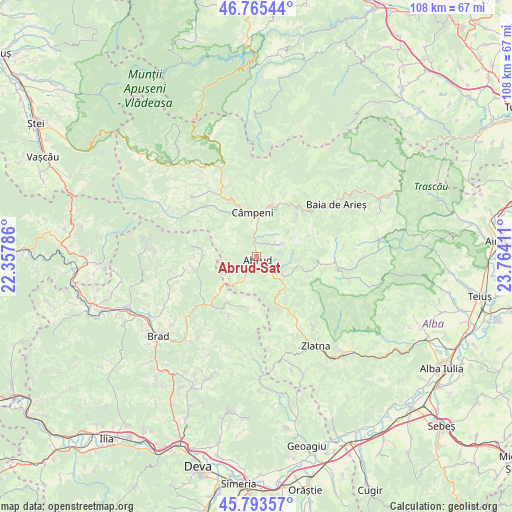
Abrud-Sat GPS coordinates[2]
46° 16' 53.976" North, 23° 3' 39.528" East
| Map corner | latitude | longitude |
|---|---|---|
| Upper-left | 46.76544°, | 22.35786° |
| Center: | 46.28166°, | 23.06098° |
| Lower-right: | 45.79357°, | 23.76411° |
| Map W x H: | 108.1×108.1 km | = 67.2×67.2mi |
| max Lat: | 48.23793° ⇑38.4% North |
| Abrud-Sat: | 46.28166° |
| min Lat: | ⇓61.6% South 43.65638° |
| min Long | Abrud-Sat | max Long |
| 20.31667° | 23.06098° | 29.65403° |
| W 16.4%⇐ | ⇒83.6% E |
Elevation
Elevation of Abrud-Sat is 617 m = 2024 ft, and this is 362.1 m = 1188 ft above average elevation for this country.
| Max E: |
1278 m = 4193 ft | 5.3% |
| Abrud-Sat | 617 m 2024 ft | |
| Avg. | 254.9 m = 836 ft | |
Min E: |
-2 m = -7 ft | 94.7% |
See also: Romania elevation on elevation.city.
Geographical zone
Abrud-Sat is located in North temperate zone (between Tropic of Cancer and the Arctic Circle). Distance of this North polar circle is 2255.1 km =1401.3 mi to North.| Distance of | km | miles | from Abrud-Sat |
|---|---|---|---|
| North Pole | 4861 | 3020.5 | to North |
| Arctic Circle | 2255.1 | 1401.3 | to North |
| Tropic Cancer | 2540.1 | 1578.3 | to South |
| Equator | 5146 | 3197.6 | to South |


Nearby cities:
15 places around Abrud-Sat: (largest is in red/bold)
• Abrud
0.9 km =0.6 mi,  167°
167°
• Bistra
11.2 km =7 mi,  15°
15°
• Blideşti
5.9 km =3.7 mi,  69°
69°
• Blăjeni
13.5 km =8.4 mi,  246°
246°
• Buceş
14.7 km =9.1 mi,  221°
221°
• Bucium
9.3 km =5.8 mi,  102°
102°
• Bucium
13.1 km =8.1 mi,  114°
114°
• Ciuruleasa
4.1 km =2.5 mi,  211°
211°
• Câmpeni
9.5 km =5.9 mi,  354°
354°
• Dăroaia
2.7 km =1.7 mi,  343°
343°
• Lupşa
14.3 km =8.9 mi,  48°
48°
• Mușca
11.9 km =7.4 mi, 45°
• Roșia Montană
6.2 km =3.9 mi,  63°
63°
• Sohodol
8.6 km =5.3 mi, 343°
• Stănija
13.4 km =8.3 mi, 205°
Sources, notices
• [Note1] Compared only with cities in Romania existing in our database
• [Src1] Map data: © OpenStreetMap contributors (CC-BY-SA)
• [Src2] Other city data from geonames.org with taken over terms of usage.
• [Src3] Geographical zone / Annual Mean Temperature by Robert A. Rohde @ Wikipedia
