Jelenča geodata
Jelenča (Central Serbia) is a populated place; located in Serbia in Europe/Belgrade (GMT+2) time zone. With population of 1,950 people, there are 221 cities with bigger population in this country. Compared to other cities in Serbia, 57.4% of cities are located further ↑North; 76% of cities are located further →East and 58.5% of cities have higher elevation than Jelenča. Note1


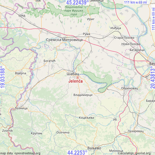
Jelenča GPS coordinates[2]
44° 43' 37.2" North, 19° 44' 6" East
| Map corner | latitude | longitude |
|---|---|---|
| Upper-left | 45.22439°, | 19.03188° |
| Center: | 44.727°, | 19.735° |
| Lower-right: | 44.2253°, | 20.43813° |
| Map W x H: | 111.1×111.1 km | = 69×69mi |
| max Lat: | 46.1° ⇑57.4% North |
| Jelenča: | 44.727° |
| min Lat: | ⇓42.6% South 42.25846° |
| min Long | Jelenča | max Long |
| 18.9276° | 19.735° | 22.77556° |
| W 24%⇐ | ⇒76% E |
Elevation
Elevation of Jelenča is 83 m = 272 ft, and this is 93.4 m = 306 ft below average elevation for this country.
| Max E: |
1421 m = 4662 ft | 58.5% |
| Avg. | 176.4 m = 579 ft | |
| Jelenča | 83 m = 272 ft | |
Min E: |
49 m = 161 ft | 41.5% |
See also: Serbia elevation on elevation.city.
Geographical zone
Jelenča is located in North temperate zone (between Tropic of Cancer and the Arctic Circle). Distance of this Northern Tropic circle is 2367.3 km =1471 mi to South.| Distance of | km | miles | from Jelenča |
|---|---|---|---|
| North Pole | 5033.9 | 3127.9 | to North |
| Arctic Circle | 2428 | 1508.7 | to North |
| Tropic Cancer | 2367.3 | 1471 | to South |
| Equator | 4973.2 | 3090.2 | to South |


Nearby cities:
15 places around Jelenča: (largest is in red/bold)
• Bogosavac
11.1 km =6.9 mi,  264°
264°
• Dobrić
12.6 km =7.8 mi, 257°
• Grabovci
9.7 km =6 mi,  64°
64°
• Jevremovac
5.7 km =3.5 mi, 264°
• Klenak
7.1 km =4.4 mi,  343°
343°
• Majur
8 km =5 mi,  307°
307°
• Nakučani
15 km =9.3 mi,  201°
201°
• Platičevo
11.6 km =7.2 mi,  24°
24°
• Pocerski Pričinović
2.3 km =1.4 mi, 256°
• Sinošević
14.7 km =9.1 mi,  212°
212°
• Tabanović
12.7 km =7.9 mi,  324°
324°
• Varna
8.5 km =5.3 mi,  231°
231°
• Vladimirci
13.1 km =8.1 mi,  162°
162°
• Šabac
4.2 km =2.6 mi,  301°
301°
• Štitar
13.3 km =8.3 mi, 304°
Sources, notices
• [Note1] Compared only with cities in Serbia existing in our database
• [Src1] Map data: © OpenStreetMap contributors (CC-BY-SA)
• [Src2] Other city data from geonames.org with taken over terms of usage.
• [Src3] Geographical zone / Annual Mean Temperature by Robert A. Rohde @ Wikipedia
