Srpska Crnja geodata
Srpska Crnja (Vojvodina) is a populated place; located in Serbia in Europe/Belgrade (GMT+2) time zone. With population of 5,467 people, there are 83 cities with bigger population in this country. Compared to other cities in Serbia, 92.5% of cities are located further ↓South; 66.7% of cities are located further ←West and 90.7% of cities have higher elevation than Srpska Crnja. Note1


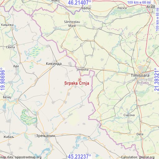
Srpska Crnja GPS coordinates[2]
45° 43' 31.368" North, 20° 41' 24.288" East
| Map corner | latitude | longitude |
|---|---|---|
| Upper-left | 46.21407°, | 19.98696° |
| Center: | 45.72538°, | 20.69008° |
| Lower-right: | 45.23237°, | 21.39321° |
| Map W x H: | 109.2×109.2 km | = 67.9×67.9mi |
| max Lat: | 46.1° ⇑7.5% North |
| Srpska Crnja: | 45.72538° |
| min Lat: | ⇓92.5% South 42.25846° |
| min Long | Srpska Crnja | max Long |
| 18.9276° | 20.69008° | 22.77556° |
| W 66.7%⇐ | ⇒33.3% E |
Elevation
Elevation of Srpska Crnja is 76 m = 249 ft, and this is 100.4 m = 329 ft below average elevation for this country.
| Max E: |
1421 m = 4662 ft | 90.7% |
| Avg. | 176.4 m = 579 ft | |
| Srpska Crnja | 76 m = 249 ft | |
Min E: |
49 m = 161 ft | 9.3% |
See also: Serbia elevation on elevation.city.
Geographical zone
Srpska Crnja is located in North temperate zone (between Tropic of Cancer and the Arctic Circle). Distance of this North polar circle is 2317 km =1439.7 mi to North.| Distance of | km | miles | from Srpska Crnja |
|---|---|---|---|
| North Pole | 4922.9 | 3058.9 | to North |
| Arctic Circle | 2317 | 1439.7 | to North |
| Tropic Cancer | 2478.3 | 1539.9 | to South |
| Equator | 5084.2 | 3159.2 | to South |


Nearby cities:
15 places around Srpska Crnja: (largest is in red/bold)
• Aleksandrovo
12.3 km =7.6 mi,  217°
217°
• Banatska Topola
18.4 km =11.4 mi,  251°
251°
• Banatsko Karađorđevo
18.2 km =11.3 mi,  212°
212°
• Banatsko Veliko Selo
12.3 km =7.6 mi,  328°
328°
• Hetin
10.6 km =6.6 mi,  131°
131°
• Kikinda
20.9 km =13 mi,  303°
303°
• Nakovo
19.2 km =11.9 mi, 330°
• Nova Crnja
9.2 km =5.7 mi,  226°
226°
• Novi Itebej
18.5 km =11.5 mi,  177°
177°
• Novi Kozarci
8.2 km =5.1 mi,  320°
320°
• Radojevo
8 km =5 mi,  73°
73°
• Rusko Selo
10.1 km =6.3 mi,  294°
294°
• Srpski Itebej
17.7 km =11 mi,  174°
174°
• Toba
11.1 km =6.9 mi, 248°
• Vojvoda Stepa
5.2 km =3.2 mi, 211°
Sources, notices
• [Note1] Compared only with cities in Serbia existing in our database
• [Src1] Map data: © OpenStreetMap contributors (CC-BY-SA)
• [Src2] Other city data from geonames.org with taken over terms of usage.
• [Src3] Geographical zone / Annual Mean Temperature by Robert A. Rohde @ Wikipedia
