Toba geodata
Toba (Vojvodina) is a populated place; located in Serbia in Europe/Belgrade (GMT+2) time zone. With population of 1,099 people, there are 307 cities with bigger population in this country. Compared to other cities in Serbia, 91.6% of cities are located further ↓South; 61% of cities are located further ←West and 84.8% of cities have higher elevation than Toba. Note1


Toba GPS coordinates[2]
45° 41' 21.948" North, 20° 33' 25.704" East
| Map corner | latitude | longitude |
|---|---|---|
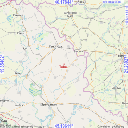
| Upper-left | 46.17844°, | 19.85402° |
| Center: | 45.68943°, | 20.55714° |
| Lower-right: | 45.19611°, | 21.26027° |
| Map W x H: | 109.2×109.2 km | = 67.9×67.9mi |
| max Lat: | 46.1° ⇑8.4% North |
| Toba: | 45.68943° |
| min Lat: | ⇓91.6% South 42.25846° |
| min Long | Toba | max Long |
| 18.9276° | 20.55714° | 22.77556° |
| W 61%⇐ | ⇒39% E |
Elevation
Elevation of Toba is 77 m = 253 ft, and this is 99.4 m = 326 ft below average elevation for this country.
| Max E: |
1421 m = 4662 ft | 84.8% |
| Avg. | 176.4 m = 579 ft | |
| Toba | 77 m = 253 ft | |
Min E: |
49 m = 161 ft | 15.2% |
See also: Serbia elevation on elevation.city.
Geographical zone
Toba is located in North temperate zone (between Tropic of Cancer and the Arctic Circle). Distance of this North polar circle is 2321 km =1442.2 mi to North.| Distance of | km | miles | from Toba |
|---|---|---|---|
| North Pole | 4926.9 | 3061.4 | to North |
| Arctic Circle | 2321 | 1442.2 | to North |
| Tropic Cancer | 2474.3 | 1537.5 | to South |
| Equator | 5080.2 | 3156.7 | to South |


Nearby cities:
15 places around Toba: (largest is in red/bold)
• Aleksandrovo
6.4 km =4 mi,  154°
154°
• Banatska Topola
7.4 km =4.6 mi,  255°
255°
• Banatsko Karađorđevo
11.4 km =7.1 mi,  177°
177°
• Banatsko Veliko Selo
15 km =9.3 mi,  15°
15°
• Bašaid
12.3 km =7.6 mi,  244°
244°
• Kikinda
17.1 km =10.6 mi,  335°
335°
• Nova Crnja
4.4 km =2.7 mi,  122°
122°
• Novi Itebej
18.3 km =11.4 mi,  142°
142°
• Novi Kozarci
11.5 km =7.1 mi,  26°
26°
• Rusko Selo
8.2 km =5.1 mi,  7°
7°
• Srpska Crnja
11.1 km =6.9 mi,  68°
68°
• Srpski Itebej
18.2 km =11.3 mi, 138°
• Torda
14 km =8.7 mi,  213°
213°
• Vojvoda Stepa
7.6 km =4.7 mi,  93°
93°
• Čestereg
14.1 km =8.8 mi,  187°
187°
Sources, notices
• [Note1] Compared only with cities in Serbia existing in our database
• [Src1] Map data: © OpenStreetMap contributors (CC-BY-SA)
• [Src2] Other city data from geonames.org with taken over terms of usage.
• [Src3] Geographical zone / Annual Mean Temperature by Robert A. Rohde @ Wikipedia
