Kuanda geodata
Kuanda (Transbaikal Territory) is a populated place; located in Russia in Asia/Chita (GMT+9) time zone. With population of 9,601 people, there are 1567 cities with bigger population in this country. Compared to other cities in Russia, 70.8% of cities are located further ↓South; 92.4% of cities are located further ←West and 92% of cities have lower elevation than Kuanda. Note1


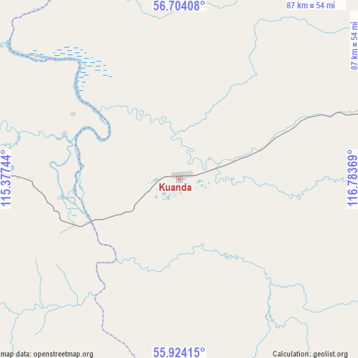
Kuanda GPS coordinates[2]
56° 18' 57.996" North, 116° 4' 50.016" East
| Map corner | latitude | longitude |
|---|---|---|
| Upper-left | 56.70408°, | 115.37744° |
| Center: | 56.31611°, | 116.08056° |
| Lower-right: | 55.92415°, | 116.78369° |
| Map W x H: | 86.7×86.7 km | = 53.9×53.9mi |
| max Lat: | 73.50819° ⇑29.2% North |
| Kuanda: | 56.31611° |
| min Lat: | ⇓70.8% South 41.28413° |
| min Long | Kuanda | max Long |
| -179.12198° | 116.08056° | 179.35046° |
| W 92.4%⇐ | ⇒7.6% E |
Elevation
Elevation of Kuanda is 506 m = 1660 ft, and this is 303.4 m = 995 ft above average elevation for this country.
| Max E: |
2518 m = 8261 ft | 8% |
| Kuanda | 506 m 1660 ft | |
| Avg. | 202.6 m = 665 ft | |
Min E: |
-28 m = -92 ft | 92% |
See also: Russia elevation on elevation.city.
Geographical zone
Kuanda is located in North temperate zone (between Tropic of Cancer and the Arctic Circle). Distance of this North polar circle is 1139.4 km =708 mi to North.| Distance of | km | miles | from Kuanda |
|---|---|---|---|
| North Pole | 3745.3 | 2327.2 | to North |
| Arctic Circle | 1139.4 | 708 | to North |
| Tropic Cancer | 3655.8 | 2271.6 | to South |
| Equator | 6261.8 | 3890.9 | to South |


Nearby cities:
15 places around Kuanda: (largest is in red/bold)
• Bagdarin
261.5 km =162.5 mi,  216°
216°
• Balakhninskiy
217.5 km =135.1 mi,  330°
330°
• Bodaybo
205.2 km =127.5 mi, 326°
• Bukachacha
374.4 km =232.6 mi,  171°
171°
• Chara
148.8 km =92.5 mi,  63°
63°
• Kropotkin
248.1 km =154.2 mi,  349°
349°
• Lugovskiy
273 km =169.6 mi,  315°
315°
• Mama
292.7 km =181.9 mi, 319°
• Mamakan
208.8 km =129.7 mi, 323°
• Novaya Chara
146.8 km =91.2 mi,  67°
67°
• Severomuysk
165.1 km =102.6 mi,  263°
263°
• Taksimo
72.8 km =45.2 mi,  272°
272°
• Vitimskiy
271.4 km =168.6 mi, 321°
• Yanchukan
202.7 km =126 mi, 267°
• Zhireken
396 km =246.1 mi, 168°
Sources, notices
• [Note1] Compared only with cities in Russia existing in our database
• [Src1] Map data: © OpenStreetMap contributors (CC-BY-SA)
• [Src2] Other city data from geonames.org with taken over terms of usage.
• [Src3] Geographical zone / Annual Mean Temperature by Robert A. Rohde @ Wikipedia
