Severomuysk geodata
Severomuysk (Buryatiya Republic) is a populated place; located in Russia in Asia/Irkutsk (GMT+8) time zone. With population of 3,962 people, there are 3132 cities with bigger population in this country. Compared to other cities in Russia, 68.6% of cities are located further ↓South; 91.7% of cities are located further ←West and 99.4% of cities have lower elevation than Severomuysk. Note1


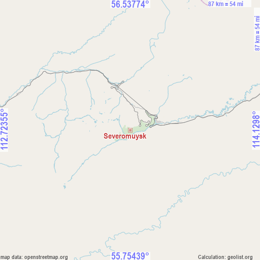
Severomuysk GPS coordinates[2]
56° 8' 53.016" North, 113° 25' 36.012" East
| Map corner | latitude | longitude |
|---|---|---|
| Upper-left | 56.53774°, | 112.72355° |
| Center: | 56.14806°, | 113.42667° |
| Lower-right: | 55.75439°, | 114.1298° |
| Map W x H: | 87.1×87.1 km | = 54.1×54.1mi |
| max Lat: | 73.50819° ⇑31.4% North |
| Severomuysk: | 56.14806° |
| min Lat: | ⇓68.6% South 41.28413° |
| min Long | Severomuysk | max Long |
| -179.12198° | 113.42667° | 179.35046° |
| W 91.7%⇐ | ⇒8.3% E |
Elevation
Elevation of Severomuysk is 1470 m = 4823 ft, and this is 1267.4 m = 4158 ft above average elevation for this country.
| Max E: |
2518 m = 8261 ft | 0.59999999999999% |
| Severomuysk | 1470 m 4823 ft | |
| Avg. | 202.6 m = 665 ft | |
Min E: |
-28 m = -92 ft | 99.4% |
See also: Russia elevation on elevation.city.
Geographical zone
Severomuysk is located in North temperate zone (between Tropic of Cancer and the Arctic Circle). Distance of this North polar circle is 1158.1 km =719.6 mi to North.| Distance of | km | miles | from Severomuysk |
|---|---|---|---|
| North Pole | 3764 | 2338.8 | to North |
| Arctic Circle | 1158.1 | 719.6 | to North |
| Tropic Cancer | 3637.2 | 2260.1 | to South |
| Equator | 6243.1 | 3879.3 | to South |


Nearby cities:
15 places around Severomuysk: (largest is in red/bold)
• Bagdarin
191 km =118.7 mi,  176°
176°
• Balakhninskiy
213.4 km =132.6 mi,  13°
13°
• Bodaybo
194.9 km =121.1 mi, 13°
• Gorno-Chuyskiy
195.8 km =121.7 mi,  328°
328°
• Kichera
207.8 km =129.1 mi,  263°
263°
• Kuanda
165.1 km =102.6 mi,  83°
83°
• Lugovskiy
215.2 km =133.7 mi,  351°
351°
• Mama
242.5 km =150.7 mi, 352°
• Mamakan
188.7 km =117.3 mi, 10°
• Nizhneangarsk
242.5 km =150.7 mi, 260°
• Novyy Uoyan
106.6 km =66.2 mi,  270°
270°
• Sogdiondon
188.3 km =117 mi,  335°
335°
• Taksimo
93.6 km =58.2 mi, 76°
• Vitimskiy
231 km =143.5 mi,  357°
357°
• Yanchukan
40.5 km =25.2 mi,  286°
286°
Sources, notices
• [Note1] Compared only with cities in Russia existing in our database
• [Src1] Map data: © OpenStreetMap contributors (CC-BY-SA)
• [Src2] Other city data from geonames.org with taken over terms of usage.
• [Src3] Geographical zone / Annual Mean Temperature by Robert A. Rohde @ Wikipedia
