Tomari geodata
Tomari (Sakhalin Oblast) is a populated place; located in Russia in Asia/Sakhalin (GMT+11) time zone. With population of 4,910 people, there are 2706 cities with bigger population in this country. Compared to other cities in Russia, 80.8% of cities are located further ↑North; 98.1% of cities are located further ←West and 95.9% of cities have higher elevation than Tomari. Note1


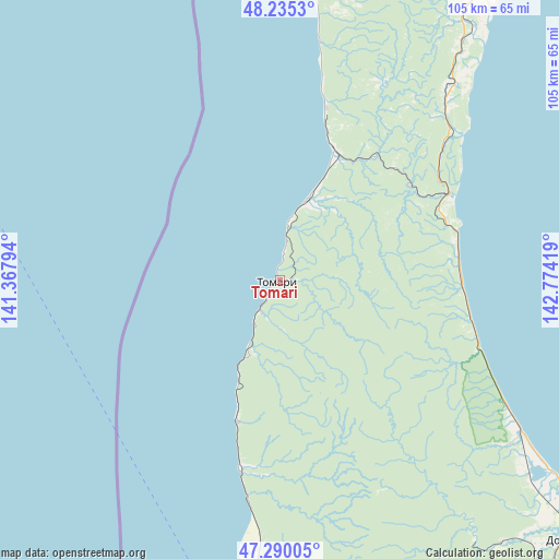
Tomari GPS coordinates[2]
47° 45' 53.352" North, 142° 4' 15.816" East
| Map corner | latitude | longitude |
|---|---|---|
| Upper-left | 48.2353°, | 141.36794° |
| Center: | 47.76482°, | 142.07106° |
| Lower-right: | 47.29005°, | 142.77419° |
| Map W x H: | 105.1×105.1 km | = 65.3×65.3mi |
| max Lat: | 73.50819° ⇑80.8% North |
| Tomari: | 47.76482° |
| min Lat: | ⇓19.2% South 41.28413° |
| min Long | Tomari | max Long |
| -179.12198° | 142.07106° | 179.35046° |
| W 98.1%⇐ | ⇒1.9% E |
Elevation
Elevation of Tomari is 10 m = 33 ft, and this is 192.6 m = 632 ft below average elevation for this country.
| Max E: |
2518 m = 8261 ft | 95.9% |
| Avg. | 202.6 m = 665 ft | |
| Tomari | 10 m = 33 ft | |
Min E: |
-28 m = -92 ft | 4.1% |
See also: Russia elevation on elevation.city.
Geographical zone
Tomari is located in North temperate zone (between Tropic of Cancer and the Arctic Circle). Distance of this North polar circle is 2090.2 km =1298.8 mi to North.| Distance of | km | miles | from Tomari |
|---|---|---|---|
| North Pole | 4696.1 | 2918 | to North |
| Arctic Circle | 2090.2 | 1298.8 | to North |
| Tropic Cancer | 2705 | 1680.8 | to South |
| Equator | 5311 | 3300.1 | to South |


Nearby cities:
15 places around Tomari: (largest is in red/bold)
• Bykov
61.6 km =38.3 mi,  143°
143°
• Chekhov
35.5 km =22.1 mi,  189°
189°
• Dolinsk
72.7 km =45.2 mi,  131°
131°
• Kholmsk
79.8 km =49.6 mi,  181°
181°
• Krasnogorsk
72.6 km =45.1 mi,  0°
0°
• Makarov
109.3 km =67.9 mi,  28°
28°
• Pravda
91.9 km =57.1 mi, 183°
• Sinegorsk
73.8 km =45.9 mi,  153°
153°
• Sokol
77.2 km =48 mi, 138°
• Troitskoye
102.9 km =63.9 mi,  155°
155°
• Uglezavodsk
64.7 km =40.2 mi, 139°
• Vostochnyy
69.1 km =42.9 mi,  36°
36°
• Vzmor’ye
34.5 km =21.4 mi,  74°
74°
• Yablochnyy
68.1 km =42.3 mi, 180°
• Yuzhno-Sakhalinsk
103.1 km =64.1 mi, 150°
Sources, notices
• [Note1] Compared only with cities in Russia existing in our database
• [Src1] Map data: © OpenStreetMap contributors (CC-BY-SA)
• [Src2] Other city data from geonames.org with taken over terms of usage.
• [Src3] Geographical zone / Annual Mean Temperature by Robert A. Rohde @ Wikipedia
