Makarov geodata
Makarov (Sakhalin Oblast) is a populated place; located in Russia in Asia/Sakhalin (GMT+11) time zone. With population of 6,663 people, there are 2084 cities with bigger population in this country. Compared to other cities in Russia, 79.6% of cities are located further ↑North; 98.5% of cities are located further ←West and 93.7% of cities have higher elevation than Makarov. Note1


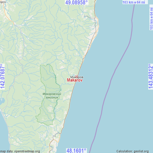
Makarov GPS coordinates[2]
48° 37' 37.128" North, 142° 46' 47.964" East
| Map corner | latitude | longitude |
|---|---|---|
| Upper-left | 49.08958°, | 142.07687° |
| Center: | 48.62698°, | 142.77999° |
| Lower-right: | 48.1601°, | 143.48312° |
| Map W x H: | 103.3×103.3 km | = 64.2×64.2mi |
| max Lat: | 73.50819° ⇑79.6% North |
| Makarov: | 48.62698° |
| min Lat: | ⇓20.4% South 41.28413° |
| min Long | Makarov | max Long |
| -179.12198° | 142.77999° | 179.35046° |
| W 98.5%⇐ | ⇒1.5% E |
Elevation
Elevation of Makarov is 16 m = 52 ft, and this is 186.6 m = 612 ft below average elevation for this country.
| Max E: |
2518 m = 8261 ft | 93.7% |
| Avg. | 202.6 m = 665 ft | |
| Makarov | 16 m = 52 ft | |
Min E: |
-28 m = -92 ft | 6.3% |
See also: Russia elevation on elevation.city.
Geographical zone
Makarov is located in North temperate zone (between Tropic of Cancer and the Arctic Circle). Distance of this North polar circle is 1994.4 km =1239.3 mi to North.| Distance of | km | miles | from Makarov |
|---|---|---|---|
| North Pole | 4600.2 | 2858.4 | to North |
| Arctic Circle | 1994.4 | 1239.3 | to North |
| Tropic Cancer | 2800.9 | 1740.4 | to South |
| Equator | 5406.8 | 3359.6 | to South |


Nearby cities:
15 places around Makarov: (largest is in red/bold)
• Boshnyakovo
121.6 km =75.6 mi,  338°
338°
• Gastello
54.3 km =33.7 mi,  13°
13°
• Krasnogorsk
56.1 km =34.9 mi,  245°
245°
• Leonidovo
73.6 km =45.7 mi, 5°
• Poronaysk
70.1 km =43.6 mi,  19°
19°
• Shakhtersk
76.7 km =47.7 mi,  322°
322°
• Smirnykh
124.5 km =77.4 mi,  1°
1°
• Tikhmenevo
64.7 km =40.2 mi, 7°
• Tomari
109.3 km =67.9 mi,  208°
208°
• Udarnyy
71.7 km =44.6 mi, 319°
• Uglegorsk
72.7 km =45.2 mi,  313°
313°
• Vakhrushev
42.3 km =26.3 mi, 17°
• Vostochnyy
41.9 km =26 mi,  196°
196°
• Vostok
40.2 km =25 mi, 14°
• Vzmor’ye
88.7 km =55.1 mi,  192°
192°
Sources, notices
• [Note1] Compared only with cities in Russia existing in our database
• [Src1] Map data: © OpenStreetMap contributors (CC-BY-SA)
• [Src2] Other city data from geonames.org with taken over terms of usage.
• [Src3] Geographical zone / Annual Mean Temperature by Robert A. Rohde @ Wikipedia
