Poronaysk geodata
Poronaysk (Sakhalin Oblast) is a populated place; located in Russia in Asia/Sakhalin (GMT+11) time zone. With population of 16,677 people, there are 1012 cities with bigger population in this country. Compared to other cities in Russia, 78.8% of cities are located further ↑North; 98.7% of cities are located further ←West and 97.1% of cities have higher elevation than Poronaysk. Note1


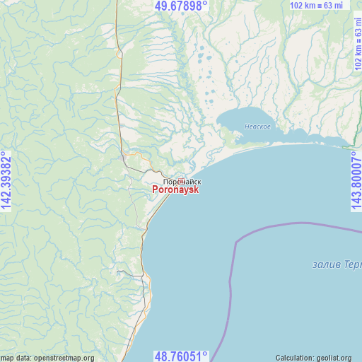
Poronaysk GPS coordinates[2]
49° 13' 18.768" North, 143° 5' 48.984" East
| Map corner | latitude | longitude |
|---|---|---|
| Upper-left | 49.67898°, | 142.39382° |
| Center: | 49.22188°, | 143.09694° |
| Lower-right: | 48.76051°, | 143.80007° |
| Map W x H: | 102.1×102.1 km | = 63.4×63.4mi |
| max Lat: | 73.50819° ⇑78.8% North |
| Poronaysk: | 49.22188° |
| min Lat: | ⇓21.2% South 41.28413° |
| min Long | Poronaysk | max Long |
| -179.12198° | 143.09694° | 179.35046° |
| W 98.7%⇐ | ⇒1.3% E |
Elevation
Elevation of Poronaysk is 7 m = 23 ft, and this is 195.6 m = 642 ft below average elevation for this country.
| Max E: |
2518 m = 8261 ft | 97.1% |
| Avg. | 202.6 m = 665 ft | |
| Poronaysk | 7 m = 23 ft | |
Min E: |
-28 m = -92 ft | 2.9% |
See also: Russia elevation on elevation.city.
Geographical zone
Poronaysk is located in North temperate zone (between Tropic of Cancer and the Arctic Circle). Distance of this North polar circle is 1928.2 km =1198.1 mi to North.| Distance of | km | miles | from Poronaysk |
|---|---|---|---|
| North Pole | 4534.1 | 2817.4 | to North |
| Arctic Circle | 1928.2 | 1198.1 | to North |
| Tropic Cancer | 2867 | 1781.5 | to South |
| Equator | 5473 | 3400.8 | to South |


Nearby cities:
15 places around Poronaysk: (largest is in red/bold)
• Boshnyakovo
81.9 km =50.9 mi,  305°
305°
• Gastello
16.8 km =10.4 mi,  216°
216°
• Krasnogorsk
116.1 km =72.1 mi, 219°
• Leonidovo
18 km =11.2 mi,  293°
293°
• Makarov
70.1 km =43.6 mi,  199°
199°
• Shakhtersk
70 km =43.5 mi,  265°
265°
• Smirnykh
61.2 km =38 mi,  342°
342°
• Tikhmenevo
15 km =9.3 mi,  262°
262°
• Tomari
178.8 km =111.1 mi,  205°
205°
• Udarnyy
70.6 km =43.9 mi, 260°
• Uglegorsk
76.7 km =47.7 mi, 258°
• Vakhrushev
27.8 km =17.3 mi, 202°
• Vostochnyy
111.9 km =69.5 mi, 198°
• Vostok
30.2 km =18.8 mi, 205°
• Vzmor’ye
158.5 km =98.5 mi, 195°
Sources, notices
• [Note1] Compared only with cities in Russia existing in our database
• [Src1] Map data: © OpenStreetMap contributors (CC-BY-SA)
• [Src2] Other city data from geonames.org with taken over terms of usage.
• [Src3] Geographical zone / Annual Mean Temperature by Robert A. Rohde @ Wikipedia
