Stan-Bekhtemir geodata
Stan-Bekhtemir (Altai Krai) is a populated place; located in Russia in Asia/Barnaul (GMT+7) time zone. With population of 1,100 people, there are 4575 cities with bigger population in this country. Compared to other cities in Russia, 65.5% of cities are located further ↑North; 82.8% of cities are located further ←West and 70.2% of cities have lower elevation than Stan-Bekhtemir. Note1


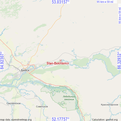
Stan-Bekhtemir GPS coordinates[2]
52° 36' 23.94" North, 85° 37' 34.284" East
| Map corner | latitude | longitude |
|---|---|---|
| Upper-left | 53.03157°, | 84.92307° |
| Center: | 52.60665°, | 85.62619° |
| Lower-right: | 52.17757°, | 86.32932° |
| Map W x H: | 95×95 km | = 59×59mi |
| max Lat: | 73.50819° ⇑65.5% North |
| Stan-Bekhtemir: | 52.60665° |
| min Lat: | ⇓34.5% South 41.28413° |
| min Long | Stan-Bekhtemir | max Long |
| -179.12198° | 85.62619° | 179.35046° |
| W 82.8%⇐ | ⇒17.2% E |
Elevation
Elevation of Stan-Bekhtemir is 198 m = 650 ft, and this is 4.6 m = 15 ft below average elevation for this country.
| Max E: |
2518 m = 8261 ft | 29.8% |
| Avg. | 202.6 m = 665 ft | |
| Stan-Bekhtemir | 198 m = 650 ft | |
Min E: |
-28 m = -92 ft | 70.2% |
See also: Russia elevation on elevation.city.
Geographical zone
Stan-Bekhtemir is located in North temperate zone (between Tropic of Cancer and the Arctic Circle). Distance of this North polar circle is 1551.9 km =964.3 mi to North.| Distance of | km | miles | from Stan-Bekhtemir |
|---|---|---|---|
| North Pole | 4157.8 | 2583.5 | to North |
| Arctic Circle | 1551.9 | 964.3 | to North |
| Tropic Cancer | 3243.4 | 2015.4 | to South |
| Equator | 5849.3 | 3634.6 | to South |


Nearby cities:
15 places around Stan-Bekhtemir: (largest is in red/bold)
• Berëzovka
31.5 km =19.6 mi,  154°
154°
• Biysk
29.4 km =18.3 mi,  254°
254°
• Kokshi
25.7 km =16 mi,  193°
193°
• Krasnyy Yar
33.9 km =21.1 mi,  215°
215°
• Lesnoye
29.4 km =18.3 mi,  238°
238°
• Malougrenevo
20.2 km =12.6 mi, 254°
• Novikovo
22.9 km =14.2 mi,  85°
85°
• Pervomayskoye
24.9 km =15.5 mi,  268°
268°
• Souskanikha
23.2 km =14.4 mi,  101°
101°
• Srostki
21.2 km =13.2 mi,  166°
166°
• Sukhaya Chemrovka
20.4 km =12.7 mi,  309°
309°
• Usyatskoye
10.1 km =6.3 mi,  115°
115°
• Verkh-Katunskoye
21.8 km =13.5 mi, 217°
• Verkhniy Bekhtemir
26.1 km =16.2 mi,  47°
47°
• Zarya
30.4 km =18.9 mi, 267°
Sources, notices
• [Note1] Compared only with cities in Russia existing in our database
• [Src1] Map data: © OpenStreetMap contributors (CC-BY-SA)
• [Src2] Other city data from geonames.org with taken over terms of usage.
• [Src3] Geographical zone / Annual Mean Temperature by Robert A. Rohde @ Wikipedia
