Usyatskoye geodata
Usyatskoye (Altai Krai) is a populated place; located in Russia in Asia/Barnaul (GMT+7) time zone. With population of 1,400 people, there are 4429 cities with bigger population in this country. Compared to other cities in Russia, 65.8% of cities are located further ↑North; 83.1% of cities are located further ←West and 65.4% of cities have lower elevation than Usyatskoye. Note1


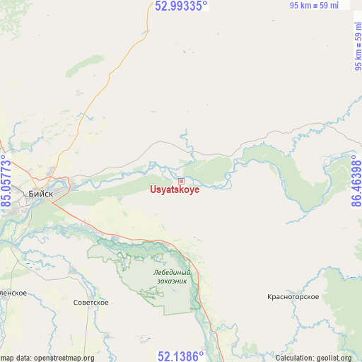
Usyatskoye GPS coordinates[2]
52° 34' 5.016" North, 85° 45' 39.06" East
| Map corner | latitude | longitude |
|---|---|---|
| Upper-left | 52.99335°, | 85.05773° |
| Center: | 52.56806°, | 85.76085° |
| Lower-right: | 52.1386°, | 86.46398° |
| Map W x H: | 95×95 km | = 59×59mi |
| max Lat: | 73.50819° ⇑65.8% North |
| Usyatskoye: | 52.56806° |
| min Lat: | ⇓34.2% South 41.28413° |
| min Long | Usyatskoye | max Long |
| -179.12198° | 85.76085° | 179.35046° |
| W 83.1%⇐ | ⇒16.9% E |
Elevation
Elevation of Usyatskoye is 183 m = 600 ft, and this is 19.6 m = 64 ft below average elevation for this country.
| Max E: |
2518 m = 8261 ft | 34.6% |
| Avg. | 202.6 m = 665 ft | |
| Usyatskoye | 183 m = 600 ft | |
Min E: |
-28 m = -92 ft | 65.4% |
See also: Russia elevation on elevation.city.
Geographical zone
Usyatskoye is located in North temperate zone (between Tropic of Cancer and the Arctic Circle). Distance of this North polar circle is 1556.2 km =967 mi to North.| Distance of | km | miles | from Usyatskoye |
|---|---|---|---|
| North Pole | 4162 | 2586.1 | to North |
| Arctic Circle | 1556.2 | 967 | to North |
| Tropic Cancer | 3239.1 | 2012.7 | to South |
| Equator | 5845 | 3631.9 | to South |


Nearby cities:
15 places around Usyatskoye: (largest is in red/bold)
• Berëzovka
24.5 km =15.2 mi,  169°
169°
• Bystryanka
31.7 km =19.7 mi, 171°
• Karabinka
35.7 km =22.2 mi,  67°
67°
• Kokshi
25.6 km =15.9 mi,  216°
216°
• Lesnoye
35.9 km =22.3 mi,  252°
252°
• Malougrenevo
28.5 km =17.7 mi,  267°
267°
• Neninka
31.8 km =19.8 mi, 68°
• Novikovo
15 km =9.3 mi, 66°
• Pervomayskoye
34.2 km =21.3 mi,  275°
275°
• Souskanikha
13.7 km =8.5 mi,  90°
90°
• Srostki
16.9 km =10.5 mi,  194°
194°
• Stan-Bekhtemir
10.1 km =6.3 mi,  295°
295°
• Sukhaya Chemrovka
30.2 km =18.8 mi, 304°
• Verkh-Katunskoye
25.9 km =16.1 mi,  239°
239°
• Verkhniy Bekhtemir
24.2 km =15 mi,  24°
24°
Sources, notices
• [Note1] Compared only with cities in Russia existing in our database
• [Src1] Map data: © OpenStreetMap contributors (CC-BY-SA)
• [Src2] Other city data from geonames.org with taken over terms of usage.
• [Src3] Geographical zone / Annual Mean Temperature by Robert A. Rohde @ Wikipedia
