Zelenogorsk geodata
Zelenogorsk (St.-Petersburg) is a populated place; located in Russia in Europe/Moscow (GMT+3) time zone. With population of 14,958 people, there are 1093 cities with bigger population in this country. Compared to other cities in Russia, 91.3% of cities are located further ↓South; 97.6% of cities are located further →East and 89.6% of cities have higher elevation than Zelenogorsk. Note1


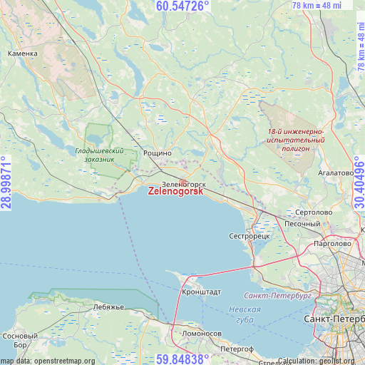
Zelenogorsk GPS coordinates[2]
60° 11' 58.848" North, 29° 42' 6.588" East
| Map corner | latitude | longitude |
|---|---|---|
| Upper-left | 60.54726°, | 28.99871° |
| Center: | 60.19968°, | 29.70183° |
| Lower-right: | 59.84838°, | 30.40496° |
| Map W x H: | 77.7×77.7 km | = 48.3×48.3mi |
| max Lat: | 73.50819° ⇑8.7% North |
| Zelenogorsk: | 60.19968° |
| min Lat: | ⇓91.3% South 41.28413° |
| min Long | Zelenogorsk | max Long |
| -179.12198° | 29.70183° | 179.35046° |
| W 2.4%⇐ | ⇒97.6% E |
Elevation
Elevation of Zelenogorsk is 30 m = 98 ft, and this is 172.6 m = 566 ft below average elevation for this country.
| Max E: |
2518 m = 8261 ft | 89.6% |
| Avg. | 202.6 m = 665 ft | |
| Zelenogorsk | 30 m = 98 ft | |
Min E: |
-28 m = -92 ft | 10.4% |
See also: Russia elevation on elevation.city.
Geographical zone
Zelenogorsk is located in North temperate zone (between Tropic of Cancer and the Arctic Circle). Distance of this North polar circle is 707.6 km =439.7 mi to North.| Distance of | km | miles | from Zelenogorsk |
|---|---|---|---|
| North Pole | 3313.5 | 2058.9 | to North |
| Arctic Circle | 707.6 | 439.7 | to North |
| Tropic Cancer | 4087.7 | 2540 | to South |
| Equator | 6693.6 | 4159.2 | to South |


Nearby cities:
15 places around Zelenogorsk: (largest is in red/bold)
• Beloostrov
17.4 km =10.8 mi,  108°
108°
• Il’ichëvo
8.1 km =5 mi,  20°
20°
• Komarovo
6.1 km =3.8 mi,  103°
103°
• Kurortnyy
12 km =7.5 mi, 108°
• Leninskoye
8.3 km =5.2 mi,  74°
74°
• Molodezhnoye
10.3 km =6.4 mi,  268°
268°
• Pervomayskoye
17.9 km =11.1 mi,  7°
7°
• Razliv
20.1 km =12.5 mi,  131°
131°
• Repino
9.7 km =6 mi, 108°
• Roshchino
7.8 km =4.8 mi,  318°
318°
• Sestroretsk
18.4 km =11.4 mi, 127°
• Smolyachkovo
12.7 km =7.9 mi,  260°
260°
• Solnechnoye
14.4 km =8.9 mi, 109°
• Ushkovo
4.2 km =2.6 mi, 273°
• Yakovlevo
15.8 km =9.8 mi,  311°
311°
Sources, notices
• [Note1] Compared only with cities in Russia existing in our database
• [Src1] Map data: © OpenStreetMap contributors (CC-BY-SA)
• [Src2] Other city data from geonames.org with taken over terms of usage.
• [Src3] Geographical zone / Annual Mean Temperature by Robert A. Rohde @ Wikipedia
