Zagoryanskiy geodata
Zagoryanskiy (Moscow Oblast) is a populated place; located in Russia in Europe/Moscow (GMT+3) time zone. With population of 7,514 people, there are 1900 cities with bigger population in this country. Compared to other cities in Russia, 65.6% of cities are located further ↓South; 77.6% of cities are located further →East and 50.7% of cities have higher elevation than Zagoryanskiy. Note1


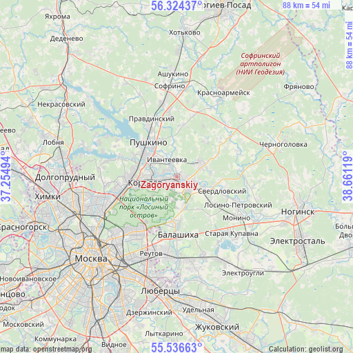
Zagoryanskiy GPS coordinates[2]
55° 55' 57" North, 37° 57' 29.016" East
| Map corner | latitude | longitude |
|---|---|---|
| Upper-left | 56.32437°, | 37.25494° |
| Center: | 55.9325°, | 37.95806° |
| Lower-right: | 55.53663°, | 38.66119° |
| Map W x H: | 87.6×87.6 km | = 54.4×54.4mi |
| max Lat: | 73.50819° ⇑34.4% North |
| Zagoryanskiy: | 55.9325° |
| min Lat: | ⇓65.6% South 41.28413° |
| min Long | Zagoryanskiy | max Long |
| -179.12198° | 37.95806° | 179.35046° |
| W 22.4%⇐ | ⇒77.6% E |
Elevation
Elevation of Zagoryanskiy is 143 m = 469 ft, and this is 59.6 m = 196 ft below average elevation for this country.
| Max E: |
2518 m = 8261 ft | 50.7% |
| Avg. | 202.6 m = 665 ft | |
| Zagoryanskiy | 143 m = 469 ft | |
Min E: |
-28 m = -92 ft | 49.3% |
See also: Russia elevation on elevation.city.
Geographical zone
Zagoryanskiy is located in North temperate zone (between Tropic of Cancer and the Arctic Circle). Distance of this North polar circle is 1182.1 km =734.5 mi to North.| Distance of | km | miles | from Zagoryanskiy |
|---|---|---|---|
| North Pole | 3788 | 2353.8 | to North |
| Arctic Circle | 1182.1 | 734.5 | to North |
| Tropic Cancer | 3613.2 | 2245.1 | to South |
| Equator | 6219.1 | 3864.4 | to South |


Nearby cities:
15 places around Zagoryanskiy: (largest is in red/bold)
• Bakhchivandzhi
9.5 km =5.9 mi,  125°
125°
• Bolshevo
8 km =5 mi,  271°
271°
• Chkalovskiy
8.5 km =5.3 mi,  119°
119°
• Dolgoye Lëdovo
8 km =5 mi,  172°
172°
• Fryazino
6.3 km =3.9 mi,  60°
60°
• Grebnevo
7.8 km =4.8 mi,  75°
75°
• Ivanteyevka
4.9 km =3 mi,  331°
331°
• Korolev
8.5 km =5.3 mi,  256°
256°
• Lesnyye Polyany
6.8 km =4.2 mi,  303°
303°
• Mamontovka
10.2 km =6.3 mi, 301°
• Medvezh’i Ozëra
7.2 km =4.5 mi, 166°
• Pushkino
11 km =6.8 mi, 328°
• Shchelkovo
1.2 km =0.7 mi, 133°
• Tarasovka
7.7 km =4.8 mi,  291°
291°
• Yubileyny
7.8 km =4.8 mi, 270°
Sources, notices
• [Note1] Compared only with cities in Russia existing in our database
• [Src1] Map data: © OpenStreetMap contributors (CC-BY-SA)
• [Src2] Other city data from geonames.org with taken over terms of usage.
• [Src3] Geographical zone / Annual Mean Temperature by Robert A. Rohde @ Wikipedia
