Velikiy Ustyug geodata
Velikiy Ustyug (Vologda) is a populated place; located in Russia in Europe/Moscow (GMT+3) time zone. With population of 32,642 people, there are 613 cities with bigger population in this country. Compared to other cities in Russia, 92.5% of cities are located further ↓South; 53.6% of cities are located further ←West and 79.6% of cities have higher elevation than Velikiy Ustyug. Note1


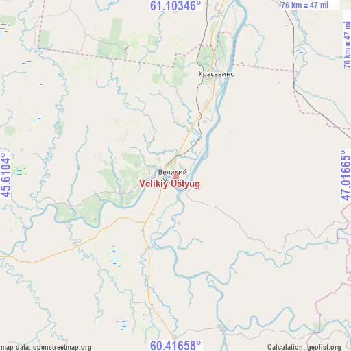
Velikiy Ustyug GPS coordinates[2]
60° 45' 42.696" North, 46° 18' 48.672" East
| Map corner | latitude | longitude |
|---|---|---|
| Upper-left | 61.10346°, | 45.6104° |
| Center: | 60.76186°, | 46.31352° |
| Lower-right: | 60.41658°, | 47.01665° |
| Map W x H: | 76.4×76.4 km | = 47.5×47.5mi |
| max Lat: | 73.50819° ⇑7.5% North |
| Velikiy Ustyug: | 60.76186° |
| min Lat: | ⇓92.5% South 41.28413° |
| min Long | Velikiy Ustyug | max Long |
| -179.12198° | 46.31352° | 179.35046° |
| W 53.6%⇐ | ⇒46.4% E |
Elevation
Elevation of Velikiy Ustyug is 72 m = 236 ft, and this is 130.6 m = 428 ft below average elevation for this country.
| Max E: |
2518 m = 8261 ft | 79.6% |
| Avg. | 202.6 m = 665 ft | |
| Velikiy Ustyug | 72 m = 236 ft | |
Min E: |
-28 m = -92 ft | 20.4% |
See also: Russia elevation on elevation.city.
Geographical zone
Velikiy Ustyug is located in North temperate zone (between Tropic of Cancer and the Arctic Circle). Distance of this North polar circle is 645.1 km =400.8 mi to North.| Distance of | km | miles | from Velikiy Ustyug |
|---|---|---|---|
| North Pole | 3251 | 2020.1 | to North |
| Arctic Circle | 645.1 | 400.8 | to North |
| Tropic Cancer | 4150.2 | 2578.8 | to South |
| Equator | 6756.1 | 4198 | to South |


Nearby cities:
15 places around Velikiy Ustyug: (largest is in red/bold)
• Cheremushskiy
76.5 km =47.5 mi,  42°
42°
• Dem’yanovo
62.1 km =38.6 mi,  137°
137°
• Khristoforovo
53.2 km =33.1 mi,  73°
73°
• Kizema
89.1 km =55.4 mi,  295°
295°
• Koryazhma
76.8 km =47.7 mi, 36°
• Kotlas
58 km =36 mi,  18°
18°
• Krasavino
24.1 km =15 mi, 22°
• Lal’sk
69.2 km =43 mi,  91°
91°
• Luza
53.1 km =33 mi,  105°
105°
• Podosinovets
67.8 km =42.1 mi, 142°
• Privodino
36.4 km =22.6 mi, 16°
• Shipitsyno
58.7 km =36.5 mi,  10°
10°
• Sol’vychegodsk
71 km =44.1 mi,  27°
27°
• Udimskiy
47.4 km =29.5 mi,  332°
332°
• Vychegodskiy
62.5 km =38.8 mi, 30°
Sources, notices
• [Note1] Compared only with cities in Russia existing in our database
• [Src1] Map data: © OpenStreetMap contributors (CC-BY-SA)
• [Src2] Other city data from geonames.org with taken over terms of usage.
• [Src3] Geographical zone / Annual Mean Temperature by Robert A. Rohde @ Wikipedia
