Lal’sk geodata
Lal’sk (Kirov) is a populated place; located in Russia in Europe/Kirov (GMT+3) time zone. With population of 4,400 people, there are 2909 cities with bigger population in this country. Compared to other cities in Russia, 92.5% of cities are located further ↓South; 57.7% of cities are located further ←West and 71.5% of cities have higher elevation than Lal’sk. Note1


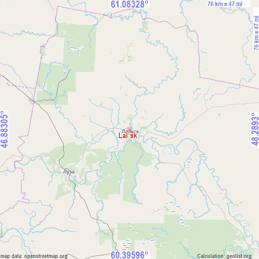
Lal’sk GPS coordinates[2]
60° 44' 29.256" North, 47° 35' 10.212" East
| Map corner | latitude | longitude |
|---|---|---|
| Upper-left | 61.08328°, | 46.88305° |
| Center: | 60.74146°, | 47.58617° |
| Lower-right: | 60.39596°, | 48.2893° |
| Map W x H: | 76.4×76.4 km | = 47.5×47.5mi |
| max Lat: | 73.50819° ⇑7.5% North |
| Lal’sk: | 60.74146° |
| min Lat: | ⇓92.5% South 41.28413° |
| min Long | Lal’sk | max Long |
| -179.12198° | 47.58617° | 179.35046° |
| W 57.7%⇐ | ⇒42.3% E |
Elevation
Elevation of Lal’sk is 99 m = 325 ft, and this is 103.6 m = 340 ft below average elevation for this country.
| Max E: |
2518 m = 8261 ft | 71.5% |
| Avg. | 202.6 m = 665 ft | |
| Lal’sk | 99 m = 325 ft | |
Min E: |
-28 m = -92 ft | 28.5% |
See also: Russia elevation on elevation.city.
Geographical zone
Lal’sk is located in North temperate zone (between Tropic of Cancer and the Arctic Circle). Distance of this North polar circle is 647.4 km =402.3 mi to North.| Distance of | km | miles | from Lal’sk |
|---|---|---|---|
| North Pole | 3253.2 | 2021.4 | to North |
| Arctic Circle | 647.4 | 402.3 | to North |
| Tropic Cancer | 4147.9 | 2577.4 | to South |
| Equator | 6753.8 | 4196.6 | to South |


Nearby cities:
15 places around Lal’sk: (largest is in red/bold)
• Cheremushskiy
61.6 km =38.3 mi,  343°
343°
• Dem’yanovo
51.4 km =31.9 mi,  212°
212°
• Il’insko-Podomskoye
46.6 km =29 mi,  27°
27°
• Kharitonovo
73.5 km =45.7 mi,  356°
356°
• Khristoforovo
25.1 km =15.6 mi,  314°
314°
• Koryazhma
67.5 km =41.9 mi, 340°
• Kotlas
76.4 km =47.5 mi,  318°
318°
• Krasavino
64.6 km =40.1 mi,  292°
292°
• Luza
22 km =13.7 mi,  235°
235°
• Pinyug
55.6 km =34.5 mi,  168°
168°
• Podosinovets
58.9 km =36.6 mi, 208°
• Privodino
69.4 km =43.1 mi,  302°
302°
• Sol’vychegodsk
74.8 km =46.5 mi,  331°
331°
• Velikiy Ustyug
69.2 km =43 mi,  271°
271°
• Vychegodskiy
67.3 km =41.8 mi, 326°
Sources, notices
• [Note1] Compared only with cities in Russia existing in our database
• [Src1] Map data: © OpenStreetMap contributors (CC-BY-SA)
• [Src2] Other city data from geonames.org with taken over terms of usage.
• [Src3] Geographical zone / Annual Mean Temperature by Robert A. Rohde @ Wikipedia
