Uzunovo geodata
Uzunovo (Moscow Oblast) is a populated place; located in Russia in Europe/Moscow (GMT+3) time zone. With population of 3,371 people, there are 3485 cities with bigger population in this country. Compared to other cities in Russia, 50.8% of cities are located further ↑North; 73.9% of cities are located further →East and 53.1% of cities have lower elevation than Uzunovo. Note1


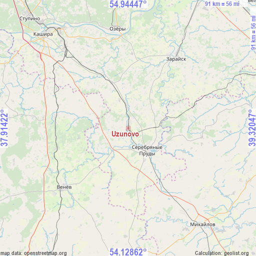
Uzunovo GPS coordinates[2]
54° 32' 18.888" North, 38° 37' 2.424" East
| Map corner | latitude | longitude |
|---|---|---|
| Upper-left | 54.94447°, | 37.91422° |
| Center: | 54.53858°, | 38.61734° |
| Lower-right: | 54.12862°, | 39.32047° |
| Map W x H: | 90.7×90.7 km | = 56.4×56.4mi |
| max Lat: | 73.50819° ⇑50.8% North |
| Uzunovo: | 54.53858° |
| min Lat: | ⇓49.2% South 41.28413° |
| min Long | Uzunovo | max Long |
| -179.12198° | 38.61734° | 179.35046° |
| W 26.1%⇐ | ⇒73.9% E |
Elevation
Elevation of Uzunovo is 152 m = 499 ft, and this is 50.6 m = 166 ft below average elevation for this country.
| Max E: |
2518 m = 8261 ft | 46.9% |
| Avg. | 202.6 m = 665 ft | |
| Uzunovo | 152 m = 499 ft | |
Min E: |
-28 m = -92 ft | 53.1% |
See also: Russia elevation on elevation.city.
Geographical zone
Uzunovo is located in North temperate zone (between Tropic of Cancer and the Arctic Circle). Distance of this North polar circle is 1337.1 km =830.8 mi to North.| Distance of | km | miles | from Uzunovo |
|---|---|---|---|
| North Pole | 3942.9 | 2450 | to North |
| Arctic Circle | 1337.1 | 830.8 | to North |
| Tropic Cancer | 3458.2 | 2148.8 | to South |
| Equator | 6064.1 | 3768.1 | to South |


Nearby cities:
15 places around Uzunovo: (largest is in red/bold)
• Biorki
57.2 km =35.5 mi,  359°
359°
• Gritsovskiy
53.5 km =33.2 mi,  213°
213°
• Kashira
44.7 km =27.8 mi,  319°
319°
• Krasnoye
11.9 km =7.4 mi,  174°
174°
• Lukhovitsy
55.9 km =34.7 mi,  29°
29°
• Mikhaylov
43.4 km =27 mi,  142°
142°
• Oktyabr’skiy
39 km =24.2 mi,  152°
152°
• Ozherel’ye
36.1 km =22.4 mi, 321°
• Ozëry
36 km =22.4 mi,  353°
353°
• Serebryanyye Prudy
10.2 km =6.3 mi, 139°
• Stupino
53.4 km =33.2 mi, 318°
• Venëv
30.4 km =18.9 mi,  227°
227°
• Vilenka
35.7 km =22.2 mi, 147°
• Zakharovo
46.9 km =29.1 mi,  114°
114°
• Zaraysk
29.8 km =18.5 mi, 34°
Sources, notices
• [Note1] Compared only with cities in Russia existing in our database
• [Src1] Map data: © OpenStreetMap contributors (CC-BY-SA)
• [Src2] Other city data from geonames.org with taken over terms of usage.
• [Src3] Geographical zone / Annual Mean Temperature by Robert A. Rohde @ Wikipedia
