Venëv geodata
Venëv (Tula) is a populated place; located in Russia in Europe/Moscow (GMT+3) time zone. With population of 15,700 people, there are 1047 cities with bigger population in this country. Compared to other cities in Russia, 52.4% of cities are located further ↑North; 75.5% of cities are located further →East and 68% of cities have lower elevation than Venëv. Note1


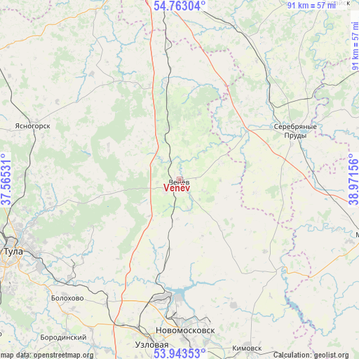
Venëv GPS coordinates[2]
54° 21' 19.188" North, 38° 16' 6.348" East
| Map corner | latitude | longitude |
|---|---|---|
| Upper-left | 54.76304°, | 37.56531° |
| Center: | 54.35533°, | 38.26843° |
| Lower-right: | 53.94353°, | 38.97156° |
| Map W x H: | 91.1×91.1 km | = 56.6×56.6mi |
| max Lat: | 73.50819° ⇑52.4% North |
| Venëv: | 54.35533° |
| min Lat: | ⇓47.6% South 41.28413° |
| min Long | Venëv | max Long |
| -179.12198° | 38.26843° | 179.35046° |
| W 24.5%⇐ | ⇒75.5% E |
Elevation
Elevation of Venëv is 191 m = 627 ft, and this is 11.6 m = 38 ft below average elevation for this country.
| Max E: |
2518 m = 8261 ft | 32% |
| Avg. | 202.6 m = 665 ft | |
| Venëv | 191 m = 627 ft | |
Min E: |
-28 m = -92 ft | 68% |
See also: Russia elevation on elevation.city.
Geographical zone
Venëv is located in North temperate zone (between Tropic of Cancer and the Arctic Circle). Distance of this North polar circle is 1357.4 km =843.4 mi to North.| Distance of | km | miles | from Venëv |
|---|---|---|---|
| North Pole | 3963.3 | 2462.7 | to North |
| Arctic Circle | 1357.4 | 843.4 | to North |
| Tropic Cancer | 3437.8 | 2136.1 | to South |
| Equator | 6043.7 | 3755.4 | to South |


Nearby cities:
15 places around Venëv: (largest is in red/bold)
• Bolokhovo
41.6 km =25.8 mi,  223°
223°
• Donskoy
43 km =26.7 mi,  174°
174°
• Gritsovskiy
25.2 km =15.7 mi,  196°
196°
• Kamenetskiy
38.1 km =23.7 mi,  184°
184°
• Krasnoye
25.3 km =15.7 mi,  70°
70°
• Novomoskovsk
38.4 km =23.9 mi, 178°
• Oktyabr’skiy
43 km =26.7 mi,  109°
109°
• Revyakino
39.3 km =24.4 mi,  271°
271°
• Serebryanyye Prudy
31.9 km =19.8 mi, 66°
• Severo-Zadonsk
36.7 km =22.8 mi, 166°
• Shvartsevskiy
34.4 km =21.4 mi,  211°
211°
• Uzlovaya
42 km =26.1 mi,  188°
188°
• Uzunovo
30.4 km =18.9 mi,  47°
47°
• Vilenka
43.1 km =26.8 mi,  102°
102°
• Yasnogorsk
39.4 km =24.5 mi,  290°
290°
Sources, notices
• [Note1] Compared only with cities in Russia existing in our database
• [Src1] Map data: © OpenStreetMap contributors (CC-BY-SA)
• [Src2] Other city data from geonames.org with taken over terms of usage.
• [Src3] Geographical zone / Annual Mean Temperature by Robert A. Rohde @ Wikipedia
