Mikhaylov geodata
Mikhaylov (Ryazan Oblast) is a populated place; located in Russia in Europe/Moscow (GMT+3) time zone. With population of 12,907 people, there are 1214 cities with bigger population in this country. Compared to other cities in Russia, 53.2% of cities are located further ↑North; 72% of cities are located further →East and 59.6% of cities have higher elevation than Mikhaylov. Note1


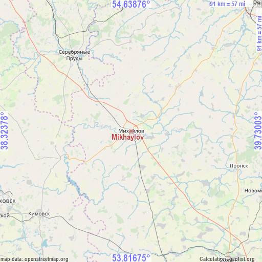
Mikhaylov GPS coordinates[2]
54° 13' 47.28" North, 39° 1' 36.84" East
| Map corner | latitude | longitude |
|---|---|---|
| Upper-left | 54.63876°, | 38.32378° |
| Center: | 54.2298°, | 39.0269° |
| Lower-right: | 53.81675°, | 39.73003° |
| Map W x H: | 91.4×91.4 km | = 56.8×56.8mi |
| max Lat: | 73.50819° ⇑53.2% North |
| Mikhaylov: | 54.2298° |
| min Lat: | ⇓46.8% South 41.28413° |
| min Long | Mikhaylov | max Long |
| -179.12198° | 39.0269° | 179.35046° |
| W 28%⇐ | ⇒72% E |
Elevation
Elevation of Mikhaylov is 125 m = 410 ft, and this is 77.6 m = 255 ft below average elevation for this country.
| Max E: |
2518 m = 8261 ft | 59.6% |
| Avg. | 202.6 m = 665 ft | |
| Mikhaylov | 125 m = 410 ft | |
Min E: |
-28 m = -92 ft | 40.4% |
See also: Russia elevation on elevation.city.
Geographical zone
Mikhaylov is located in North temperate zone (between Tropic of Cancer and the Arctic Circle). Distance of this North polar circle is 1371.4 km =852.1 mi to North.| Distance of | km | miles | from Mikhaylov |
|---|---|---|---|
| North Pole | 3977.3 | 2471.4 | to North |
| Arctic Circle | 1371.4 | 852.1 | to North |
| Tropic Cancer | 3423.9 | 2127.5 | to South |
| Equator | 6029.8 | 3746.7 | to South |


Nearby cities:
15 places around Mikhaylov: (largest is in red/bold)
• Donskoy
53.4 km =33.2 mi,  237°
237°
• Kimovsk
43.2 km =26.8 mi,  228°
228°
• Krasnoye
33.9 km =21.1 mi,  311°
311°
• Novomichurinsk
51.6 km =32.1 mi,  114°
114°
• Novomoskovsk
54.2 km =33.7 mi, 243°
• Oktyabr’skiy
8.6 km =5.3 mi,  267°
267°
• Pavelets
51.1 km =31.8 mi,  163°
163°
• Pronsk
40.4 km =25.1 mi, 110°
• Serebryanyye Prudy
33.2 km =20.6 mi,  323°
323°
• Severo-Zadonsk
46.1 km =28.6 mi, 241°
• Uzunovo
43.4 km =27 mi, 322°
• Venëv
51.2 km =31.8 mi,  285°
285°
• Vilenka
8.4 km =5.2 mi,  301°
301°
• Yepifan’
54.6 km =33.9 mi,  214°
214°
• Zakharovo
22.3 km =13.9 mi,  47°
47°
Sources, notices
• [Note1] Compared only with cities in Russia existing in our database
• [Src1] Map data: © OpenStreetMap contributors (CC-BY-SA)
• [Src2] Other city data from geonames.org with taken over terms of usage.
• [Src3] Geographical zone / Annual Mean Temperature by Robert A. Rohde @ Wikipedia
