Urazovo geodata
Urazovo (Belgorod Oblast) is a populated place; located in Russia in Europe/Moscow (GMT+3) time zone. With population of 6,966 people, there are 2010 cities with bigger population in this country. Compared to other cities in Russia, 77.8% of cities are located further ↑North; 77% of cities are located further →East and 74.4% of cities have higher elevation than Urazovo. Note1


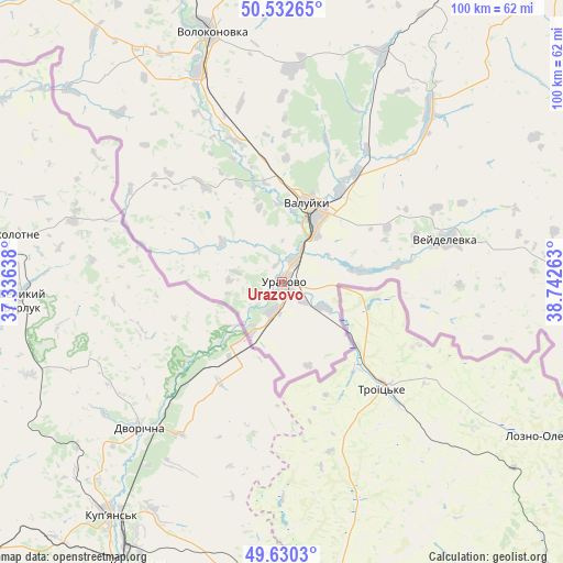
Urazovo GPS coordinates[2]
50° 5' 0.96" North, 38° 2' 22.2" East
| Map corner | latitude | longitude |
|---|---|---|
| Upper-left | 50.53265°, | 37.33638° |
| Center: | 50.0836°, | 38.0395° |
| Lower-right: | 49.6303°, | 38.74263° |
| Map W x H: | 100.3×100.3 km | = 62.3×62.3mi |
| max Lat: | 73.50819° ⇑77.8% North |
| Urazovo: | 50.0836° |
| min Lat: | ⇓22.2% South 41.28413° |
| min Long | Urazovo | max Long |
| -179.12198° | 38.0395° | 179.35046° |
| W 23%⇐ | ⇒77% E |
Elevation
Elevation of Urazovo is 90 m = 295 ft, and this is 112.6 m = 369 ft below average elevation for this country.
| Max E: |
2518 m = 8261 ft | 74.4% |
| Avg. | 202.6 m = 665 ft | |
| Urazovo | 90 m = 295 ft | |
Min E: |
-28 m = -92 ft | 25.6% |
See also: Russia elevation on elevation.city.
Geographical zone
Urazovo is located in North temperate zone (between Tropic of Cancer and the Arctic Circle). Distance of this North polar circle is 1832.4 km =1138.6 mi to North.| Distance of | km | miles | from Urazovo |
|---|---|---|---|
| North Pole | 4438.3 | 2757.8 | to North |
| Arctic Circle | 1832.4 | 1138.6 | to North |
| Tropic Cancer | 2962.9 | 1841.1 | to South |
| Equator | 5568.8 | 3460.3 | to South |


Nearby cities:
15 places around Urazovo: (largest is in red/bold)
• Alekseyevka
76.4 km =47.5 mi,  37°
37°
• Gorod Shebekino
88 km =54.7 mi,  294°
294°
• Ilovka
81.1 km =50.4 mi,  31°
31°
• Krasnogvardeyskoye
68 km =42.3 mi,  22°
22°
• Livenka
44.5 km =27.7 mi, 24°
• Novaya Tavolzhanka
91.1 km =56.6 mi, 289°
• Novyy Oskol
76.6 km =47.6 mi,  350°
350°
• Ol’khovatka
91.6 km =56.9 mi,  75°
75°
• Pyatnitskoye
40.7 km =25.3 mi,  338°
338°
• Shebekino
87.9 km =54.6 mi, 294°
• Valuyki
14.2 km =8.8 mi, 19°
• Veydelevka
30.2 km =18.8 mi, 75°
• Volokonovka
46.2 km =28.7 mi, 343°
• Zabolotovka
93.3 km =58 mi, 76°
• Zasosna
65.9 km =40.9 mi, 22°
Sources, notices
• [Note1] Compared only with cities in Russia existing in our database
• [Src1] Map data: © OpenStreetMap contributors (CC-BY-SA)
• [Src2] Other city data from geonames.org with taken over terms of usage.
• [Src3] Geographical zone / Annual Mean Temperature by Robert A. Rohde @ Wikipedia
