Uchkulan geodata
Uchkulan (Karachayevo-Cherkesiya Republic) is a populated place; located in Russia in Europe/Moscow (GMT+3) time zone. With population of 5,000 people, there are 2658 cities with bigger population in this country. Compared to other cities in Russia, 94.4% of cities are located further ↑North; 59.3% of cities are located further →East and 99.3% of cities have lower elevation than Uchkulan. Note1


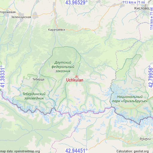
Uchkulan GPS coordinates[2]
43° 27' 25.38" North, 42° 5' 47.148" East
| Map corner | latitude | longitude |
|---|---|---|
| Upper-left | 43.96529°, | 41.39331° |
| Center: | 43.45705°, | 42.09643° |
| Lower-right: | 42.94451°, | 42.79956° |
| Map W x H: | 113.5×113.5 km | = 70.5×70.5mi |
| max Lat: | 73.50819° ⇑94.4% North |
| Uchkulan: | 43.45705° |
| min Lat: | ⇓5.6% South 41.28413° |
| min Long | Uchkulan | max Long |
| -179.12198° | 42.09643° | 179.35046° |
| W 40.7%⇐ | ⇒59.3% E |
Elevation
Elevation of Uchkulan is 1366 m = 4482 ft, and this is 1163.4 m = 3817 ft above average elevation for this country.
| Max E: |
2518 m = 8261 ft | 0.7% |
| Uchkulan | 1366 m 4482 ft | |
| Avg. | 202.6 m = 665 ft | |
Min E: |
-28 m = -92 ft | 99.3% |
See also: Russia elevation on elevation.city.
Geographical zone
Uchkulan is located in North temperate zone (between Tropic of Cancer and the Arctic Circle). Distance of this Northern Tropic circle is 2226.1 km =1383.2 mi to South.| Distance of | km | miles | from Uchkulan |
|---|---|---|---|
| North Pole | 5175.1 | 3215.7 | to North |
| Arctic Circle | 2569.2 | 1596.4 | to North |
| Tropic Cancer | 2226.1 | 1383.2 | to South |
| Equator | 4832 | 3002.5 | to South |


Nearby cities:
15 places around Uchkulan: (largest is in red/bold)
• El’brus
49.5 km =30.8 mi,  116°
116°
• Karachayevsk
38.2 km =23.7 mi,  337°
337°
• Kardonikskaya
54.9 km =34.1 mi,  325°
325°
• Kumysh
50.1 km =31.1 mi, 340°
• Kyzyl-Oktyabr’skiy
48 km =29.8 mi, 328°
• Nizhniy Arkhyz
56.9 km =35.4 mi,  295°
295°
• Novyy Karachay
43.3 km =26.9 mi, 338°
• Ordzhonikidzevskiy
45.8 km =28.5 mi, 339°
• Pervomayskoye
61.6 km =38.3 mi,  29°
29°
• Pravokubanskiy
53.9 km =33.5 mi, 341°
• Sary-Tyuz
52 km =32.3 mi, 341°
• Tereze
60.1 km =37.3 mi, 27°
• Terskol
40.5 km =25.2 mi, 123°
• Uchkeken
63 km =39.1 mi, 31°
• Zelenchukskaya
60.4 km =37.5 mi,  317°
317°
Sources, notices
• [Note1] Compared only with cities in Russia existing in our database
• [Src1] Map data: © OpenStreetMap contributors (CC-BY-SA)
• [Src2] Other city data from geonames.org with taken over terms of usage.
• [Src3] Geographical zone / Annual Mean Temperature by Robert A. Rohde @ Wikipedia
