Temryuk geodata
Temryuk (Krasnodarskiy) is a seat of a second-order administrative division; located in Russia in Europe/Moscow (GMT+3) time zone. With population of 36,546 people, there are 563 cities with bigger population in this country. Compared to other cities in Russia, 86.1% of cities are located further ↑North; 82.8% of cities are located further →East and 84.9% of cities have higher elevation than Temryuk. Note1


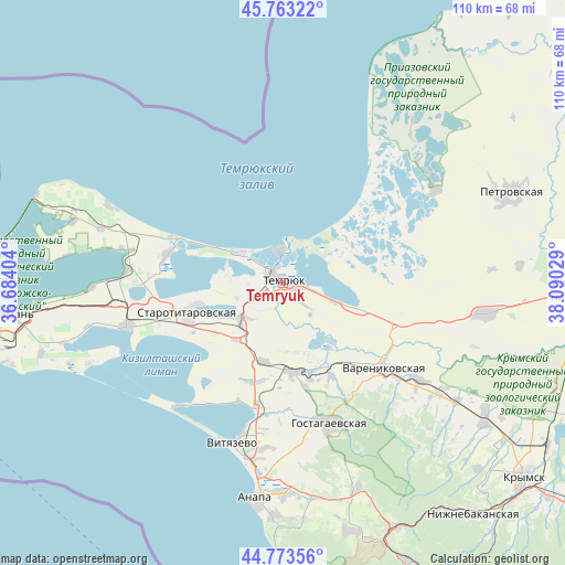
Temryuk GPS coordinates[2]
45° 16' 13.98" North, 37° 23' 13.776" East
| Map corner | latitude | longitude |
|---|---|---|
| Upper-left | 45.76322°, | 36.68404° |
| Center: | 45.27055°, | 37.38716° |
| Lower-right: | 44.77356°, | 38.09029° |
| Map W x H: | 110×110 km | = 68.4×68.4mi |
| max Lat: | 73.50819° ⇑86.1% North |
| Temryuk: | 45.27055° |
| min Lat: | ⇓13.9% South 41.28413° |
| min Long | Temryuk | max Long |
| -179.12198° | 37.38716° | 179.35046° |
| W 17.2%⇐ | ⇒82.8% E |
Elevation
Elevation of Temryuk is 48 m = 157 ft, and this is 154.6 m = 507 ft below average elevation for this country.
| Max E: |
2518 m = 8261 ft | 84.9% |
| Avg. | 202.6 m = 665 ft | |
| Temryuk | 48 m = 157 ft | |
Min E: |
-28 m = -92 ft | 15.1% |
See also: Russia elevation on elevation.city.
Geographical zone
Temryuk is located in North temperate zone (between Tropic of Cancer and the Arctic Circle). Distance of this North polar circle is 2367.6 km =1471.2 mi to North.| Distance of | km | miles | from Temryuk |
|---|---|---|---|
| North Pole | 4973.4 | 3090.3 | to North |
| Arctic Circle | 2367.6 | 1471.2 | to North |
| Tropic Cancer | 2427.7 | 1508.5 | to South |
| Equator | 5033.6 | 3127.7 | to South |


Nearby cities:
15 places around Temryuk: (largest is in red/bold)
• Akhtanizovskaya
23.1 km =14.4 mi,  284°
284°
• Blagovetschenskaya
31.2 km =19.4 mi,  219°
219°
• Chernoyerkovskaya
34.9 km =21.7 mi,  58°
58°
• Dzhiginka
15.8 km =9.8 mi,  194°
194°
• Golubitskaya
11 km =6.8 mi,  303°
303°
• Gostagayevskaya
29.1 km =18.1 mi,  161°
161°
• Korzhevskiy
27.4 km =17 mi,  108°
108°
• Starotitarovskaya
19.1 km =11.9 mi,  252°
252°
• Strelka
10.6 km =6.6 mi,  227°
227°
• Tsibanobalka
32.4 km =20.1 mi, 186°
• Varenikovskaya
26 km =16.2 mi,  129°
129°
• Vinogradnyy
24.4 km =15.2 mi, 192°
• Vityazevo
31.1 km =19.3 mi,  195°
195°
• Vyshestebliyevskaya
30.1 km =18.7 mi, 254°
• Yurovka
17.5 km =10.9 mi,  171°
171°
Sources, notices
• [Note1] Compared only with cities in Russia existing in our database
• [Src1] Map data: © OpenStreetMap contributors (CC-BY-SA)
• [Src2] Other city data from geonames.org with taken over terms of usage.
• [Src3] Geographical zone / Annual Mean Temperature by Robert A. Rohde @ Wikipedia
