Staroyur’yevo geodata
Staroyur’yevo (Tambov) is a populated place; located in Russia in Europe/Moscow (GMT+3) time zone. With population of 6,900 people, there are 2026 cities with bigger population in this country. Compared to other cities in Russia, 60.2% of cities are located further ↑North; 64.2% of cities are located further →East and 52.4% of cities have lower elevation than Staroyur’yevo. Note1


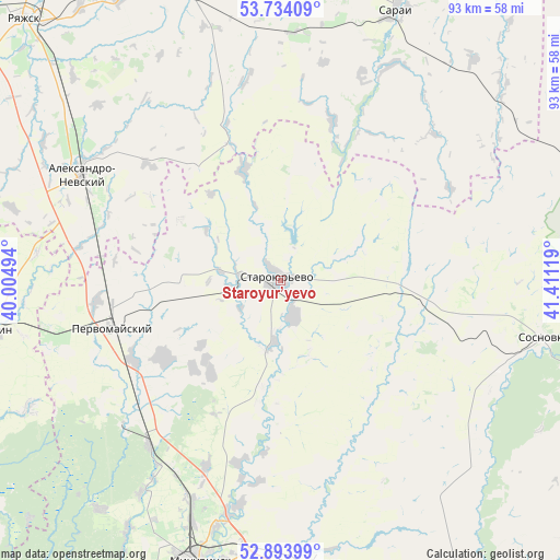
Staroyur’yevo GPS coordinates[2]
53° 18' 57.996" North, 40° 42' 29.016" East
| Map corner | latitude | longitude |
|---|---|---|
| Upper-left | 53.73409°, | 40.00494° |
| Center: | 53.31611°, | 40.70806° |
| Lower-right: | 52.89399°, | 41.41119° |
| Map W x H: | 93.4×93.4 km | = 58×58mi |
| max Lat: | 73.50819° ⇑60.2% North |
| Staroyur’yevo: | 53.31611° |
| min Lat: | ⇓39.8% South 41.28413° |
| min Long | Staroyur’yevo | max Long |
| -179.12198° | 40.70806° | 179.35046° |
| W 35.8%⇐ | ⇒64.2% E |
Elevation
Elevation of Staroyur’yevo is 150 m = 492 ft, and this is 52.6 m = 173 ft below average elevation for this country.
| Max E: |
2518 m = 8261 ft | 47.6% |
| Avg. | 202.6 m = 665 ft | |
| Staroyur’yevo | 150 m = 492 ft | |
Min E: |
-28 m = -92 ft | 52.4% |
See also: Russia elevation on elevation.city.
Geographical zone
Staroyur’yevo is located in North temperate zone (between Tropic of Cancer and the Arctic Circle). Distance of this North polar circle is 1473 km =915.3 mi to North.| Distance of | km | miles | from Staroyur’yevo |
|---|---|---|---|
| North Pole | 4078.9 | 2534.5 | to North |
| Arctic Circle | 1473 | 915.3 | to North |
| Tropic Cancer | 3322.3 | 2064.4 | to South |
| Equator | 5928.2 | 3683.6 | to South |


Nearby cities:
15 places around Staroyur’yevo: (largest is in red/bold)
• Aleksandro-Nevskiy
37.5 km =23.3 mi,  298°
298°
• Chaplygin
50.2 km =31.2 mi,  260°
260°
• Goreloye
67.8 km =42.1 mi,  128°
128°
• Kalikino
71.5 km =44.4 mi,  235°
235°
• Komsomolets
72.1 km =44.8 mi,  147°
147°
• Michurinsk
48.7 km =30.3 mi,  197°
197°
• Morozovy-Borki
72.8 km =45.2 mi,  11°
11°
• Pervomayskiy
29 km =18 mi,  254°
254°
• Ryazhsk
58.5 km =36.4 mi,  317°
317°
• Sapozhok
69.6 km =43.2 mi,  358°
358°
• Sarai
52.1 km =32.4 mi,  23°
23°
• Selezni
67.1 km =41.7 mi, 148°
• Sosnovka
44.8 km =27.8 mi,  101°
101°
• Ukholovo
54.9 km =34.1 mi,  344°
344°
• Zavoronezhskoye
49.6 km =30.8 mi,  192°
192°
Sources, notices
• [Note1] Compared only with cities in Russia existing in our database
• [Src1] Map data: © OpenStreetMap contributors (CC-BY-SA)
• [Src2] Other city data from geonames.org with taken over terms of usage.
• [Src3] Geographical zone / Annual Mean Temperature by Robert A. Rohde @ Wikipedia
