Zavoronezhskoye geodata
Zavoronezhskoye (Tambov) is a populated place; located in Russia in Europe/Moscow (GMT+3) time zone. With population of 5,645 people, there are 2384 cities with bigger population in this country. Compared to other cities in Russia, 63.5% of cities are located further ↑North; 64.7% of cities are located further →East and 59.6% of cities have higher elevation than Zavoronezhskoye. Note1


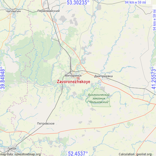
Zavoronezhskoye GPS coordinates[2]
52° 52' 48.36" North, 40° 33' 9.36" East
| Map corner | latitude | longitude |
|---|---|---|
| Upper-left | 53.30235°, | 39.84948° |
| Center: | 52.8801°, | 40.5526° |
| Lower-right: | 52.4537°, | 41.25573° |
| Map W x H: | 94.4×94.4 km | = 58.7×58.7mi |
| max Lat: | 73.50819° ⇑63.5% North |
| Zavoronezhskoye: | 52.8801° |
| min Lat: | ⇓36.5% South 41.28413° |
| min Long | Zavoronezhskoye | max Long |
| -179.12198° | 40.5526° | 179.35046° |
| W 35.3%⇐ | ⇒64.7% E |
Elevation
Elevation of Zavoronezhskoye is 125 m = 410 ft, and this is 77.6 m = 255 ft below average elevation for this country.
| Max E: |
2518 m = 8261 ft | 59.6% |
| Avg. | 202.6 m = 665 ft | |
| Zavoronezhskoye | 125 m = 410 ft | |
Min E: |
-28 m = -92 ft | 40.4% |
See also: Russia elevation on elevation.city.
Geographical zone
Zavoronezhskoye is located in North temperate zone (between Tropic of Cancer and the Arctic Circle). Distance of this North polar circle is 1521.5 km =945.4 mi to North.| Distance of | km | miles | from Zavoronezhskoye |
|---|---|---|---|
| North Pole | 4127.3 | 2564.6 | to North |
| Arctic Circle | 1521.5 | 945.4 | to North |
| Tropic Cancer | 3273.8 | 2034.2 | to South |
| Equator | 5879.7 | 3653.5 | to South |


Nearby cities:
15 places around Zavoronezhskoye: (largest is in red/bold)
• Bol’shoy Khomutets
47 km =29.2 mi,  256°
256°
• Chaplygin
56.4 km =35 mi,  315°
315°
• Dobroye
49.8 km =30.9 mi,  268°
268°
• Donskoye
63.2 km =39.3 mi,  100°
100°
• Gryazi
59.5 km =37 mi,  224°
224°
• Kalikino
49.3 km =30.6 mi,  278°
278°
• Kazinka
62.2 km =38.6 mi,  232°
232°
• Komsomolets
50.9 km =31.6 mi, 104°
• Michurinsk
4.6 km =2.9 mi,  295°
295°
• Pervomayskiy
44.6 km =27.7 mi,  336°
336°
• Plekhanovo
54.5 km =33.9 mi,  240°
240°
• Pokrovo-Prigorodnoye
62.1 km =38.6 mi,  110°
110°
• Selezni
46.9 km =29.1 mi, 100°
• Staroyur’yevo
49.6 km =30.8 mi,  12°
12°
• Tambov
62.1 km =38.6 mi, 105°
Sources, notices
• [Note1] Compared only with cities in Russia existing in our database
• [Src1] Map data: © OpenStreetMap contributors (CC-BY-SA)
• [Src2] Other city data from geonames.org with taken over terms of usage.
• [Src3] Geographical zone / Annual Mean Temperature by Robert A. Rohde @ Wikipedia
