Smolensk geodata
Smolensk is a seat of a first-order administrative division; located in Russia in Europe/Moscow (GMT+3) time zone. With population of 320,991 people, there are 58 cities with bigger population in this country. Compared to other cities in Russia, 51.1% of cities are located further ↓South; 93.4% of cities are located further →East and 80.2% of cities have lower elevation than Smolensk. Note1


Smolensk GPS coordinates[2]
54° 46' 54.48" North, 32° 2' 24.36" East
| Map corner | latitude | longitude |
|---|---|---|
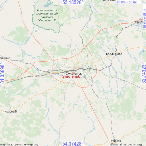
| Upper-left | 55.18526°, | 31.33698° |
| Center: | 54.7818°, | 32.0401° |
| Lower-right: | 54.37428°, | 32.74323° |
| Map W x H: | 90.2×90.2 km | = 56×56mi |
| max Lat: | 73.50819° ⇑48.9% North |
| Smolensk: | 54.7818° |
| min Lat: | ⇓51.1% South 41.28413° |
| min Long | Smolensk | max Long |
| -179.12198° | 32.0401° | 179.35046° |
| W 6.6%⇐ | ⇒93.4% E |
Elevation
Elevation of Smolensk is 250 m = 820 ft, and this is 47.4 m = 156 ft above average elevation for this country.
| Max E: |
2518 m = 8261 ft | 19.8% |
| Smolensk | 250 m 820 ft | |
| Avg. | 202.6 m = 665 ft | |
Min E: |
-28 m = -92 ft | 80.2% |
See also: Smolensk elevation on elevation.city.
Geographical zone
Smolensk is located in North temperate zone (between Tropic of Cancer and the Arctic Circle). Distance of this North polar circle is 1310 km =814 mi to North.| Distance of | km | miles | from Smolensk |
|---|---|---|---|
| North Pole | 3915.9 | 2433.2 | to North |
| Arctic Circle | 1310 | 814 | to North |
| Tropic Cancer | 3485.2 | 2165.6 | to South |
| Equator | 6091.2 | 3784.9 | to South |


Nearby cities:
15 places around Smolensk: (largest is in red/bold)
• Demidov
63.8 km =39.6 mi,  328°
328°
• Dukhovshchina
51.4 km =31.9 mi,  27°
27°
• Glinka
56.1 km =34.9 mi,  106°
106°
• Golynki
43 km =26.7 mi,  283°
283°
• Kardymovo
27.8 km =17.3 mi,  64°
64°
• Katyn'
22.4 km =13.9 mi,  267°
267°
• Khislavichi
66.6 km =41.4 mi,  173°
173°
• Monastyrshchina
49.8 km =30.9 mi,  195°
195°
• Pechersk
8 km =5 mi,  356°
356°
• Pochinok
49 km =30.4 mi,  148°
148°
• Rudnya
63.3 km =39.3 mi,  286°
286°
• Shatalovo
56.3 km =35 mi, 152°
• Talashkino
16.9 km =10.5 mi, 146°
• Yartsevo
52.6 km =32.7 mi,  52°
52°
• Yel’nya
76.9 km =47.8 mi, 107°
Sources, notices
• [Note1] Compared only with cities in Russia existing in our database
• [Src1] Map data: © OpenStreetMap contributors (CC-BY-SA)
• [Src2] Other city data from geonames.org with taken over terms of usage.
• [Src3] Geographical zone / Annual Mean Temperature by Robert A. Rohde @ Wikipedia
