Shirokovskiy geodata
Shirokovskiy (Perm) is a populated place; located in Russia in Asia/Yekaterinburg (GMT+5) time zone. With population of 1,823 people, there are 4243 cities with bigger population in this country. Compared to other cities in Russia, 86.1% of cities are located further ↓South; 69.4% of cities are located further ←West and 79.8% of cities have lower elevation than Shirokovskiy. Note1


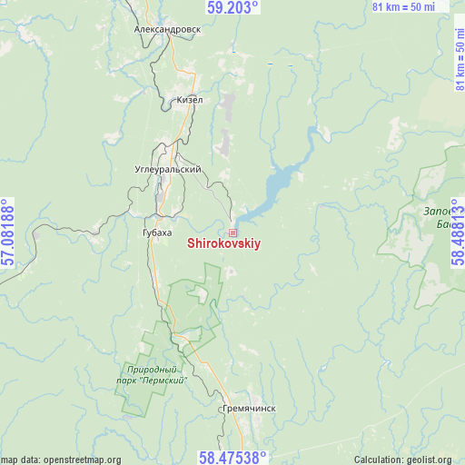
Shirokovskiy GPS coordinates[2]
58° 50' 27.96" North, 57° 47' 6" East
| Map corner | latitude | longitude |
|---|---|---|
| Upper-left | 59.203°, | 57.08188° |
| Center: | 58.8411°, | 57.785° |
| Lower-right: | 58.47538°, | 58.48813° |
| Map W x H: | 80.9×80.9 km | = 50.3×50.3mi |
| max Lat: | 73.50819° ⇑13.9% North |
| Shirokovskiy: | 58.8411° |
| min Lat: | ⇓86.1% South 41.28413° |
| min Long | Shirokovskiy | max Long |
| -179.12198° | 57.785° | 179.35046° |
| W 69.4%⇐ | ⇒30.6% E |
Elevation
Elevation of Shirokovskiy is 246 m = 807 ft, and this is 43.4 m = 142 ft above average elevation for this country.
| Max E: |
2518 m = 8261 ft | 20.2% |
| Shirokovskiy | 246 m 807 ft | |
| Avg. | 202.6 m = 665 ft | |
Min E: |
-28 m = -92 ft | 79.8% |
See also: Russia elevation on elevation.city.
Geographical zone
Shirokovskiy is located in North temperate zone (between Tropic of Cancer and the Arctic Circle). Distance of this North polar circle is 858.7 km =533.6 mi to North.| Distance of | km | miles | from Shirokovskiy |
|---|---|---|---|
| North Pole | 3464.5 | 2152.7 | to North |
| Arctic Circle | 858.7 | 533.6 | to North |
| Tropic Cancer | 3936.6 | 2446.1 | to South |
| Equator | 6542.5 | 4065.3 | to South |


Nearby cities:
15 places around Shirokovskiy: (largest is in red/bold)
• Aleksandrovsk
37.3 km =23.2 mi,  340°
340°
• Chusovoy
60 km =37.3 mi,  178°
178°
• Gornozavodsk
60.3 km =37.5 mi,  149°
149°
• Gremyachinsk
31.5 km =19.6 mi,  173°
173°
• Gubakha
13.3 km =8.3 mi,  268°
268°
• Kizel
24.2 km =15 mi, 341°
• Nagornskiy
15.9 km =9.9 mi,  239°
239°
• Pashiya
53 km =32.9 mi, 149°
• Rudnichnyy
20.4 km =12.7 mi,  334°
334°
• Severnyy-Kospashskiy
27.7 km =17.2 mi,  2°
2°
• Shakhta
28.7 km =17.8 mi,  345°
345°
• Shumikhinskiy
12 km =7.5 mi,  206°
206°
• Ugleural’skiy
15.9 km =9.9 mi,  316°
316°
• Yubileynyy
6.9 km =4.3 mi, 181°
• Yuzhnyy-Kospashskiy
14.7 km =9.1 mi, 354°
Sources, notices
• [Note1] Compared only with cities in Russia existing in our database
• [Src1] Map data: © OpenStreetMap contributors (CC-BY-SA)
• [Src2] Other city data from geonames.org with taken over terms of usage.
• [Src3] Geographical zone / Annual Mean Temperature by Robert A. Rohde @ Wikipedia
