Gornozavodsk geodata
Gornozavodsk (Perm) is a populated place; located in Russia in Asia/Yekaterinburg (GMT+5) time zone. With population of 12,796 people, there are 1218 cities with bigger population in this country. Compared to other cities in Russia, 84.2% of cities are located further ↓South; 69.8% of cities are located further ←West and 82.7% of cities have lower elevation than Gornozavodsk. Note1


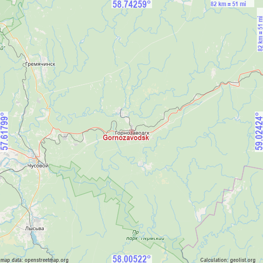
Gornozavodsk GPS coordinates[2]
58° 22' 32.988" North, 58° 19' 15.996" East
| Map corner | latitude | longitude |
|---|---|---|
| Upper-left | 58.74259°, | 57.61799° |
| Center: | 58.37583°, | 58.32111° |
| Lower-right: | 58.00522°, | 59.02424° |
| Map W x H: | 82×82 km | = 51×51mi |
| max Lat: | 73.50819° ⇑15.8% North |
| Gornozavodsk: | 58.37583° |
| min Lat: | ⇓84.2% South 41.28413° |
| min Long | Gornozavodsk | max Long |
| -179.12198° | 58.32111° | 179.35046° |
| W 69.8%⇐ | ⇒30.2% E |
Elevation
Elevation of Gornozavodsk is 281 m = 922 ft, and this is 78.4 m = 257 ft above average elevation for this country.
| Max E: |
2518 m = 8261 ft | 17.3% |
| Gornozavodsk | 281 m 922 ft | |
| Avg. | 202.6 m = 665 ft | |
Min E: |
-28 m = -92 ft | 82.7% |
See also: Russia elevation on elevation.city.
Geographical zone
Gornozavodsk is located in North temperate zone (between Tropic of Cancer and the Arctic Circle). Distance of this North polar circle is 910.4 km =565.7 mi to North.| Distance of | km | miles | from Gornozavodsk |
|---|---|---|---|
| North Pole | 3516.3 | 2184.9 | to North |
| Arctic Circle | 910.4 | 565.7 | to North |
| Tropic Cancer | 3884.9 | 2414 | to South |
| Equator | 6490.8 | 4033.2 | to South |


Nearby cities:
15 places around Gornozavodsk: (largest is in red/bold)
• Chusovoy
30.8 km =19.1 mi,  254°
254°
• Gremyachinsk
34.2 km =21.3 mi,  306°
306°
• Kalino
43.9 km =27.3 mi, 251°
• Lyamino
36.3 km =22.6 mi, 253°
• Lys’va
42.4 km =26.3 mi,  225°
225°
• Medvedka
60.9 km =37.8 mi,  48°
48°
• Nagornskiy
62.7 km =39 mi, 314°
• Pashiya
7.3 km =4.5 mi,  328°
328°
• Promysla
52.7 km =32.7 mi,  66°
66°
• Sarany
35.5 km =22.1 mi, 67°
• Shirokovskiy
60.3 km =37.5 mi, 329°
• Shumikhinskiy
54.9 km =34.1 mi,  318°
318°
• Staryy Biser
32.9 km =20.4 mi,  82°
82°
• Tëplaya Gora
46.7 km =29 mi, 69°
• Yubileynyy
54.7 km =34 mi, 325°
Sources, notices
• [Note1] Compared only with cities in Russia existing in our database
• [Src1] Map data: © OpenStreetMap contributors (CC-BY-SA)
• [Src2] Other city data from geonames.org with taken over terms of usage.
• [Src3] Geographical zone / Annual Mean Temperature by Robert A. Rohde @ Wikipedia
