Shamary geodata
Shamary (Sverdlovsk) is a populated place; located in Russia in Asia/Yekaterinburg (GMT+5) time zone. With population of 3,605 people, there are 3332 cities with bigger population in this country. Compared to other cities in Russia, 79.2% of cities are located further ↓South; 69.7% of cities are located further ←West and 79.2% of cities have lower elevation than Shamary. Note1


Shamary GPS coordinates[2]
57° 20' 36.24" North, 58° 13' 11.568" East
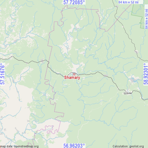
| Map corner | latitude | longitude |
|---|---|---|
| Upper-left | 57.72085°, | 57.51676° |
| Center: | 57.3434°, | 58.21988° |
| Lower-right: | 56.96203°, | 58.92301° |
| Map W x H: | 84.4×84.4 km | = 52.4×52.4mi |
| max Lat: | 73.50819° ⇑20.8% North |
| Shamary: | 57.3434° |
| min Lat: | ⇓79.2% South 41.28413° |
| min Long | Shamary | max Long |
| -179.12198° | 58.21988° | 179.35046° |
| W 69.7%⇐ | ⇒30.3% E |
Elevation
Elevation of Shamary is 241 m = 791 ft, and this is 38.4 m = 126 ft above average elevation for this country.
| Max E: |
2518 m = 8261 ft | 20.8% |
| Shamary | 241 m 791 ft | |
| Avg. | 202.6 m = 665 ft | |
Min E: |
-28 m = -92 ft | 79.2% |
See also: Russia elevation on elevation.city.
Geographical zone
Shamary is located in North temperate zone (between Tropic of Cancer and the Arctic Circle). Distance of this North polar circle is 1025.2 km =637 mi to North.| Distance of | km | miles | from Shamary |
|---|---|---|---|
| North Pole | 3631.1 | 2256.3 | to North |
| Arctic Circle | 1025.2 | 637 | to North |
| Tropic Cancer | 3770.1 | 2342.6 | to South |
| Equator | 6376 | 3961.9 | to South |


Nearby cities:
15 places around Shamary: (largest is in red/bold)
• Achit
63.6 km =39.5 mi,  197°
197°
• Bisert’
73.5 km =45.7 mi,  136°
136°
• Filippovka
72.7 km =45.2 mi,  278°
278°
• Kungur
76.2 km =47.3 mi, 277°
• Kuzino
81.8 km =50.8 mi,  115°
115°
• Nizhnyaya Irga
71.6 km =44.5 mi,  222°
222°
• Orda
80.5 km =50 mi,  258°
258°
• Shalya
32.5 km =20.2 mi,  109°
109°
• Staroutkinsk
68.2 km =42.4 mi,  100°
100°
• Suksun
54.4 km =33.8 mi,  245°
245°
• Sylva
33.4 km =20.8 mi, 96°
• Ufimskiy
71.3 km =44.3 mi,  188°
188°
• Ust’-Kishert’
58.3 km =36.2 mi,  272°
272°
• Visim
83.8 km =52.1 mi,  66°
66°
• Visimo-Utkinsk
77.8 km =48.3 mi,  60°
60°
Sources, notices
• [Note1] Compared only with cities in Russia existing in our database
• [Src1] Map data: © OpenStreetMap contributors (CC-BY-SA)
• [Src2] Other city data from geonames.org with taken over terms of usage.
• [Src3] Geographical zone / Annual Mean Temperature by Robert A. Rohde @ Wikipedia
