Shalya geodata
Shalya (Sverdlovsk) is a populated place; located in Russia in Asia/Yekaterinburg (GMT+5) time zone. With population of 6,689 people, there are 2079 cities with bigger population in this country. Compared to other cities in Russia, 78.7% of cities are located further ↓South; 70.1% of cities are located further ←West and 85.4% of cities have lower elevation than Shalya. Note1


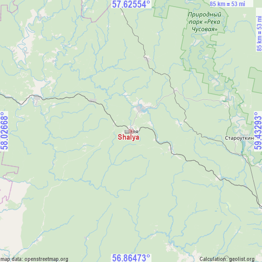
Shalya GPS coordinates[2]
57° 14' 49.56" North, 58° 43' 47.28" East
| Map corner | latitude | longitude |
|---|---|---|
| Upper-left | 57.62554°, | 58.02668° |
| Center: | 57.2471°, | 58.7298° |
| Lower-right: | 56.86473°, | 59.43293° |
| Map W x H: | 84.6×84.6 km | = 52.6×52.6mi |
| max Lat: | 73.50819° ⇑21.3% North |
| Shalya: | 57.2471° |
| min Lat: | ⇓78.7% South 41.28413° |
| min Long | Shalya | max Long |
| -179.12198° | 58.7298° | 179.35046° |
| W 70.1%⇐ | ⇒29.9% E |
Elevation
Elevation of Shalya is 330 m = 1083 ft, and this is 127.4 m = 418 ft above average elevation for this country.
| Max E: |
2518 m = 8261 ft | 14.6% |
| Shalya | 330 m 1083 ft | |
| Avg. | 202.6 m = 665 ft | |
Min E: |
-28 m = -92 ft | 85.4% |
See also: Russia elevation on elevation.city.
Geographical zone
Shalya is located in North temperate zone (between Tropic of Cancer and the Arctic Circle). Distance of this North polar circle is 1035.9 km =643.7 mi to North.| Distance of | km | miles | from Shalya |
|---|---|---|---|
| North Pole | 3641.8 | 2262.9 | to North |
| Arctic Circle | 1035.9 | 643.7 | to North |
| Tropic Cancer | 3759.4 | 2336 | to South |
| Equator | 6365.3 | 3955.2 | to South |


Nearby cities:
15 places around Shalya: (largest is in red/bold)
• Achit
70.8 km =44 mi,  225°
225°
• Atig
74.6 km =46.4 mi,  145°
145°
• Bilimbay
72.5 km =45 mi,  115°
115°
• Bisert’
47.1 km =29.3 mi,  155°
155°
• Druzhinino
69.6 km =43.2 mi,  136°
136°
• Kuzino
49.7 km =30.9 mi, 120°
• Nizhniye Sergi
73.8 km =45.9 mi, 151°
• Novoutkinsk
57.4 km =35.7 mi, 119°
• Shamary
32.5 km =20.2 mi,  289°
289°
• Staroutkinsk
36.5 km =22.7 mi,  92°
92°
• Sylva
7.4 km =4.6 mi,  20°
20°
• Ufimskiy
72.6 km =45.1 mi,  214°
214°
• Uralets
71.8 km =44.6 mi,  50°
50°
• Visim
64.2 km =39.9 mi, 45°
• Visimo-Utkinsk
61.5 km =38.2 mi,  37°
37°
Sources, notices
• [Note1] Compared only with cities in Russia existing in our database
• [Src1] Map data: © OpenStreetMap contributors (CC-BY-SA)
• [Src2] Other city data from geonames.org with taken over terms of usage.
• [Src3] Geographical zone / Annual Mean Temperature by Robert A. Rohde @ Wikipedia
