Sagopshi geodata
Sagopshi (Ingushetiya Republic) is a populated place; located in Russia in Europe/Moscow (GMT+3) time zone. With population of 11,848 people, there are 1295 cities with bigger population in this country. Compared to other cities in Russia, 94.1% of cities are located further ↑North; 51.3% of cities are located further →East and 87.9% of cities have lower elevation than Sagopshi. Note1


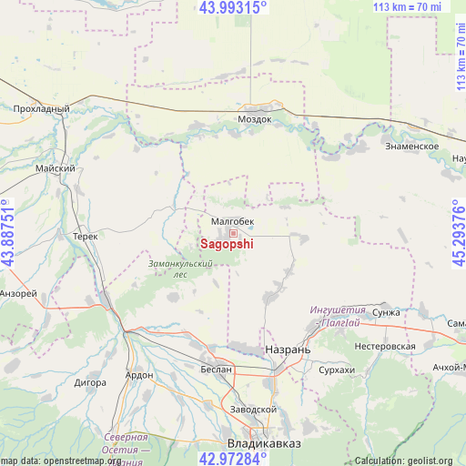
Sagopshi GPS coordinates[2]
43° 29' 6.54" North, 44° 35' 26.268" East
| Map corner | latitude | longitude |
|---|---|---|
| Upper-left | 43.99315°, | 43.88751° |
| Center: | 43.48515°, | 44.59063° |
| Lower-right: | 42.97284°, | 45.29376° |
| Map W x H: | 113.4×113.4 km | = 70.5×70.5mi |
| max Lat: | 73.50819° ⇑94.1% North |
| Sagopshi: | 43.48515° |
| min Lat: | ⇓5.9% South 41.28413° |
| min Long | Sagopshi | max Long |
| -179.12198° | 44.59063° | 179.35046° |
| W 48.7%⇐ | ⇒51.3% E |
Elevation
Elevation of Sagopshi is 397 m = 1302 ft, and this is 194.4 m = 638 ft above average elevation for this country.
| Max E: |
2518 m = 8261 ft | 12.1% |
| Sagopshi | 397 m 1302 ft | |
| Avg. | 202.6 m = 665 ft | |
Min E: |
-28 m = -92 ft | 87.9% |
See also: Russia elevation on elevation.city.
Geographical zone
Sagopshi is located in North temperate zone (between Tropic of Cancer and the Arctic Circle). Distance of this Northern Tropic circle is 2229.2 km =1385.2 mi to South.| Distance of | km | miles | from Sagopshi |
|---|---|---|---|
| North Pole | 5172 | 3213.7 | to North |
| Arctic Circle | 2566.1 | 1594.5 | to North |
| Tropic Cancer | 2229.2 | 1385.2 | to South |
| Equator | 4835.1 | 3004.4 | to South |


Nearby cities:
15 places around Sagopshi: (largest is in red/bold)
• Alkhan-Churt
21.7 km =13.5 mi,  133°
133°
• Dalakovo
27.5 km =17.1 mi,  180°
180°
• Kantyshevo
28.8 km =17.9 mi,  173°
173°
• Khumalag
28.8 km =17.9 mi,  198°
198°
• Kizlyar
24.3 km =15.1 mi,  0°
0°
• Malgobek
2.9 km =1.8 mi,  356°
356°
• Mozdok
29.2 km =18.1 mi,  9°
9°
• Nizhniye Achaluki
16.4 km =10.2 mi,  123°
123°
• Nogamerzin-Yurt
30.5 km =19 mi,  52°
52°
• Pavlodol’skaya
27.6 km =17.1 mi,  340°
340°
• Psedakh
2.6 km =1.6 mi,  220°
220°
• Staryy Malgobek
6.6 km =4.1 mi, 3°
• Terskaya
28.6 km =17.8 mi,  22°
22°
• Verkhniye Achaluki
17.6 km =10.9 mi,  150°
150°
• Voznesenskaya
14.1 km =8.8 mi,  62°
62°
Sources, notices
• [Note1] Compared only with cities in Russia existing in our database
• [Src1] Map data: © OpenStreetMap contributors (CC-BY-SA)
• [Src2] Other city data from geonames.org with taken over terms of usage.
• [Src3] Geographical zone / Annual Mean Temperature by Robert A. Rohde @ Wikipedia
