Pavlovskaya geodata
Pavlovskaya (Krasnodarskiy) is a seat of a second-order administrative division; located in Russia in Europe/Moscow (GMT+3) time zone. With population of 31,133 people, there are 630 cities with bigger population in this country. Compared to other cities in Russia, 83.8% of cities are located further ↑North; 68.6% of cities are located further →East and 85.8% of cities have higher elevation than Pavlovskaya. Note1


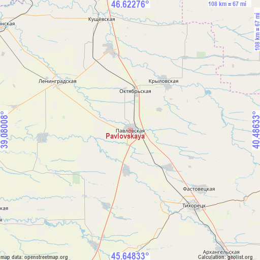
Pavlovskaya GPS coordinates[2]
46° 8' 15.72" North, 39° 46' 59.52" East
| Map corner | latitude | longitude |
|---|---|---|
| Upper-left | 46.62276°, | 39.08008° |
| Center: | 46.1377°, | 39.7832° |
| Lower-right: | 45.64833°, | 40.48633° |
| Map W x H: | 108.3×108.3 km | = 67.3×67.3mi |
| max Lat: | 73.50819° ⇑83.8% North |
| Pavlovskaya: | 46.1377° |
| min Lat: | ⇓16.2% South 41.28413° |
| min Long | Pavlovskaya | max Long |
| -179.12198° | 39.7832° | 179.35046° |
| W 31.4%⇐ | ⇒68.6% E |
Elevation
Elevation of Pavlovskaya is 44 m = 144 ft, and this is 158.6 m = 520 ft below average elevation for this country.
| Max E: |
2518 m = 8261 ft | 85.8% |
| Avg. | 202.6 m = 665 ft | |
| Pavlovskaya | 44 m = 144 ft | |
Min E: |
-28 m = -92 ft | 14.2% |
See also: Russia elevation on elevation.city.
Geographical zone
Pavlovskaya is located in North temperate zone (between Tropic of Cancer and the Arctic Circle). Distance of this North polar circle is 2271.1 km =1411.2 mi to North.| Distance of | km | miles | from Pavlovskaya |
|---|---|---|---|
| North Pole | 4877 | 3030.4 | to North |
| Arctic Circle | 2271.1 | 1411.2 | to North |
| Tropic Cancer | 2524.1 | 1568.4 | to South |
| Equator | 5130 | 3187.6 | to South |


Nearby cities:
15 places around Pavlovskaya: (largest is in red/bold)
• Atamanskaya
12.2 km =7.6 mi,  291°
291°
• Chelbasskaya
36.3 km =22.6 mi,  240°
240°
• Fastovetskaya
37.9 km =23.5 mi,  129°
129°
• Irkliyevskaya
32.8 km =20.4 mi,  197°
197°
• Kislyakovskaya
34.8 km =21.6 mi,  346°
346°
• Krylovskaya
24.8 km =15.4 mi,  35°
35°
• Krylovskaya
37.1 km =23.1 mi,  265°
265°
• Lenina
7.9 km =4.9 mi,  179°
179°
• Leningradskaya
36.6 km =22.7 mi,  303°
303°
• Novoleushkovskaya
22.6 km =14 mi, 134°
• Novoplatnirovskaya
28.3 km =17.6 mi,  262°
262°
• Novorozhdestvenskaya
33.4 km =20.8 mi,  157°
157°
• Parkovyy
43.9 km =27.3 mi,  140°
140°
• Staroleushkovskaya
16.9 km =10.5 mi,  186°
186°
• Tikhoretsk
41.1 km =25.5 mi, 139°
Sources, notices
• [Note1] Compared only with cities in Russia existing in our database
• [Src1] Map data: © OpenStreetMap contributors (CC-BY-SA)
• [Src2] Other city data from geonames.org with taken over terms of usage.
• [Src3] Geographical zone / Annual Mean Temperature by Robert A. Rohde @ Wikipedia
