Nesterovskaya geodata
Nesterovskaya (Ingushetiya Republic) is a populated place; located in Russia in Europe/Moscow (GMT+3) time zone. With population of 19,186 people, there are 905 cities with bigger population in this country. Compared to other cities in Russia, 96% of cities are located further ↑North; 50.3% of cities are located further ←West and 88.2% of cities have lower elevation than Nesterovskaya. Note1


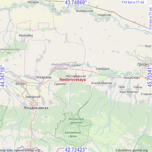
Nesterovskaya GPS coordinates[2]
43° 14' 18.996" North, 45° 3' 1.008" East
| Map corner | latitude | longitude |
|---|---|---|
| Upper-left | 43.74869°, | 44.34716° |
| Center: | 43.23861°, | 45.05028° |
| Lower-right: | 42.72423°, | 45.75341° |
| Map W x H: | 113.9×113.9 km | = 70.8×70.8mi |
| max Lat: | 73.50819° ⇑96% North |
| Nesterovskaya: | 43.23861° |
| min Lat: | ⇓4% South 41.28413° |
| min Long | Nesterovskaya | max Long |
| -179.12198° | 45.05028° | 179.35046° |
| W 50.3%⇐ | ⇒49.7% E |
Elevation
Elevation of Nesterovskaya is 405 m = 1329 ft, and this is 202.4 m = 664 ft above average elevation for this country.
| Max E: |
2518 m = 8261 ft | 11.8% |
| Nesterovskaya | 405 m 1329 ft | |
| Avg. | 202.6 m = 665 ft | |
Min E: |
-28 m = -92 ft | 88.2% |
See also: Russia elevation on elevation.city.
Geographical zone
Nesterovskaya is located in North temperate zone (between Tropic of Cancer and the Arctic Circle). Distance of this Northern Tropic circle is 2201.8 km =1368.1 mi to South.| Distance of | km | miles | from Nesterovskaya |
|---|---|---|---|
| North Pole | 5199.4 | 3230.8 | to North |
| Arctic Circle | 2593.5 | 1611.5 | to North |
| Tropic Cancer | 2201.8 | 1368.1 | to South |
| Equator | 4807.7 | 2987.4 | to South |


Nearby cities:
15 places around Nesterovskaya: (largest is in red/bold)
• Achkhoy-Martan
19.7 km =12.2 mi,  105°
105°
• Ali-Yurt
19.3 km =12 mi,  236°
236°
• Alkhan-Churt
24.8 km =15.4 mi,  300°
300°
• Assinovskaya
10.7 km =6.6 mi,  88°
88°
• Bamut
14.8 km =9.2 mi,  126°
126°
• Ekazhevo
18.6 km =11.6 mi,  260°
260°
• Galashki
14.3 km =8.9 mi,  199°
199°
• Karabulak
14.3 km =8.9 mi, 301°
• Magas
22.6 km =14 mi,  265°
265°
• Nazran’
22.5 km =14 mi, 266°
• Samashki
20.8 km =12.9 mi,  74°
74°
• Sernovodsk
12.1 km =7.5 mi,  47°
47°
• Sunzha
9 km =5.6 mi,  359°
359°
• Surkhakhi
13.3 km =8.3 mi, 244°
• Troitskaya
9.3 km =5.8 mi,  324°
324°
Sources, notices
• [Note1] Compared only with cities in Russia existing in our database
• [Src1] Map data: © OpenStreetMap contributors (CC-BY-SA)
• [Src2] Other city data from geonames.org with taken over terms of usage.
• [Src3] Geographical zone / Annual Mean Temperature by Robert A. Rohde @ Wikipedia
