Surkhakhi geodata
Surkhakhi (Ingushetiya Republic) is a populated place; located in Russia in Europe/Moscow (GMT+3) time zone. With population of 16,215 people, there are 1024 cities with bigger population in this country. Compared to other cities in Russia, 96.5% of cities are located further ↑North; 50.1% of cities are located further →East and 95.2% of cities have lower elevation than Surkhakhi. Note1


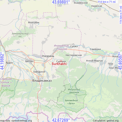
Surkhakhi GPS coordinates[2]
43° 11' 15" North, 44° 54' 6.984" East
| Map corner | latitude | longitude |
|---|---|---|
| Upper-left | 43.69801°, | 44.19882° |
| Center: | 43.1875°, | 44.90194° |
| Lower-right: | 42.67269°, | 45.60507° |
| Map W x H: | 114×114 km | = 70.8×70.8mi |
| max Lat: | 73.50819° ⇑96.5% North |
| Surkhakhi: | 43.1875° |
| min Lat: | ⇓3.5% South 41.28413° |
| min Long | Surkhakhi | max Long |
| -179.12198° | 44.90194° | 179.35046° |
| W 49.9%⇐ | ⇒50.1% E |
Elevation
Elevation of Surkhakhi is 651 m = 2136 ft, and this is 448.4 m = 1471 ft above average elevation for this country.
| Max E: |
2518 m = 8261 ft | 4.8% |
| Surkhakhi | 651 m 2136 ft | |
| Avg. | 202.6 m = 665 ft | |
Min E: |
-28 m = -92 ft | 95.2% |
See also: Russia elevation on elevation.city.
Geographical zone
Surkhakhi is located in North temperate zone (between Tropic of Cancer and the Arctic Circle). Distance of this Northern Tropic circle is 2196.1 km =1364.6 mi to South.| Distance of | km | miles | from Surkhakhi |
|---|---|---|---|
| North Pole | 5205.1 | 3234.3 | to North |
| Arctic Circle | 2599.2 | 1615.1 | to North |
| Tropic Cancer | 2196.1 | 1364.6 | to South |
| Equator | 4802 | 2983.8 | to South |


Nearby cities:
15 places around Surkhakhi: (largest is in red/bold)
• Ali-Yurt
6.4 km =4 mi,  218°
218°
• Alkhan-Churt
20.5 km =12.7 mi,  333°
333°
• Chermen
15.9 km =9.9 mi,  255°
255°
• Dachnoye
17.7 km =11 mi,  229°
229°
• Ekazhevo
7 km =4.3 mi,  293°
293°
• Galashki
10.6 km =6.6 mi,  137°
137°
• Kambileyevskoye
17.2 km =10.7 mi, 225°
• Kantyshevo
22.2 km =13.8 mi,  281°
281°
• Karabulak
13.1 km =8.1 mi,  359°
359°
• Magas
11.2 km =7 mi, 290°
• Nazran’
11.3 km =7 mi, 292°
• Nesterovskaya
13.3 km =8.3 mi,  64°
64°
• Sunzha
15.7 km =9.8 mi,  204°
204°
• Sunzha
18.9 km =11.7 mi,  39°
39°
• Troitskaya
14.8 km =9.2 mi,  26°
26°
Sources, notices
• [Note1] Compared only with cities in Russia existing in our database
• [Src1] Map data: © OpenStreetMap contributors (CC-BY-SA)
• [Src2] Other city data from geonames.org with taken over terms of usage.
• [Src3] Geographical zone / Annual Mean Temperature by Robert A. Rohde @ Wikipedia
