Lukovetskiy geodata
Lukovetskiy (Arkhangelskaya) is a populated place; located in Russia in Europe/Moscow (GMT+3) time zone. With population of 2,701 people, there are 3889 cities with bigger population in this country. Compared to other cities in Russia, 97.1% of cities are located further ↓South; 60% of cities are located further →East and 92.8% of cities have higher elevation than Lukovetskiy. Note1


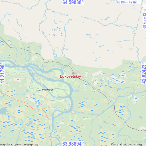
Lukovetskiy GPS coordinates[2]
64° 17' 44.16" North, 41° 55' 15.96" East
| Map corner | latitude | longitude |
|---|---|---|
| Upper-left | 64.59888°, | 41.21798° |
| Center: | 64.2956°, | 41.9211° |
| Lower-right: | 63.98894°, | 42.62423° |
| Map W x H: | 67.8×67.8 km | = 42.1×42.1mi |
| max Lat: | 73.50819° ⇑2.9% North |
| Lukovetskiy: | 64.2956° |
| min Lat: | ⇓97.1% South 41.28413° |
| min Long | Lukovetskiy | max Long |
| -179.12198° | 41.9211° | 179.35046° |
| W 40%⇐ | ⇒60% E |
Elevation
Elevation of Lukovetskiy is 19 m = 62 ft, and this is 183.6 m = 602 ft below average elevation for this country.
| Max E: |
2518 m = 8261 ft | 92.8% |
| Avg. | 202.6 m = 665 ft | |
| Lukovetskiy | 19 m = 62 ft | |
Min E: |
-28 m = -92 ft | 7.2% |
See also: Russia elevation on elevation.city.
Geographical zone
Lukovetskiy is located in North temperate zone (between Tropic of Cancer and the Arctic Circle). Distance of this North polar circle is 252.2 km =156.7 mi to North.| Distance of | km | miles | from Lukovetskiy |
|---|---|---|---|
| North Pole | 2858.1 | 1775.9 | to North |
| Arctic Circle | 252.2 | 156.7 | to North |
| Tropic Cancer | 4543.1 | 2823 | to South |
| Equator | 7149 | 4442.2 | to South |


Nearby cities:
15 places around Lukovetskiy: (largest is in red/bold)
• Arkhangel’sk
71.5 km =44.4 mi,  292°
292°
• Belogorskiy
23.6 km =14.7 mi,  120°
120°
• Isakogorka
63.2 km =39.3 mi, 285°
• Karpogory
126.6 km =78.7 mi,  104°
104°
• Katunino
63 km =39.1 mi,  279°
279°
• Kholmogory
15.1 km =9.4 mi,  237°
237°
• Kodino
128.1 km =79.6 mi, 240°
• Novodvinsk
55 km =34.2 mi, 284°
• Pinega
83.5 km =51.9 mi,  57°
57°
• Samoded
102.9 km =63.9 mi,  222°
222°
• Severodvinsk
104.7 km =65.1 mi, 286°
• Uyemskiy
55.1 km =34.2 mi, 291°
• Vas’kovo
71.3 km =44.3 mi, 280°
• Yagry
106.5 km =66.2 mi, 288°
• Yemetsk
91.8 km =57 mi,  184°
184°
Sources, notices
• [Note1] Compared only with cities in Russia existing in our database
• [Src1] Map data: © OpenStreetMap contributors (CC-BY-SA)
• [Src2] Other city data from geonames.org with taken over terms of usage.
• [Src3] Geographical zone / Annual Mean Temperature by Robert A. Rohde @ Wikipedia
