Pinega geodata
Pinega (Arkhangelskaya) is a populated place; located in Russia in Europe/Moscow (GMT+3) time zone. With population of 3,620 people, there are 3320 cities with bigger population in this country. Compared to other cities in Russia, 97.4% of cities are located further ↓South; 55.1% of cities are located further →East and 92.5% of cities have higher elevation than Pinega. Note1


Pinega GPS coordinates[2]
64° 41' 58.884" North, 43° 23' 24.576" East
| Map corner | latitude | longitude |
|---|---|---|
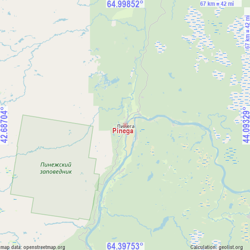
| Upper-left | 64.99852°, | 42.68704° |
| Center: | 64.69969°, | 43.39016° |
| Lower-right: | 64.39753°, | 44.09329° |
| Map W x H: | 66.8×66.8 km | = 41.5×41.5mi |
| max Lat: | 73.50819° ⇑2.6% North |
| Pinega: | 64.69969° |
| min Lat: | ⇓97.4% South 41.28413° |
| min Long | Pinega | max Long |
| -179.12198° | 43.39016° | 179.35046° |
| W 44.9%⇐ | ⇒55.1% E |
Elevation
Elevation of Pinega is 20 m = 66 ft, and this is 182.6 m = 599 ft below average elevation for this country.
| Max E: |
2518 m = 8261 ft | 92.5% |
| Avg. | 202.6 m = 665 ft | |
| Pinega | 20 m = 66 ft | |
Min E: |
-28 m = -92 ft | 7.5% |
See also: Russia elevation on elevation.city.
Geographical zone
Pinega is located in North temperate zone (between Tropic of Cancer and the Arctic Circle). Distance of this North polar circle is 207.2 km =128.7 mi to North.| Distance of | km | miles | from Pinega |
|---|---|---|---|
| North Pole | 2813.1 | 1748 | to North |
| Arctic Circle | 207.2 | 128.7 | to North |
| Tropic Cancer | 4588 | 2850.9 | to South |
| Equator | 7193.9 | 4470.1 | to South |


Nearby cities:
15 places around Pinega: (largest is in red/bold)
• Arkhangel’sk
136.8 km =85 mi,  262°
262°
• Belogorskiy
75.8 km =47.1 mi,  221°
221°
• Isakogorka
133.7 km =83.1 mi, 257°
• Kamenka
136 km =84.5 mi,  14°
14°
• Karpogory
92.7 km =57.6 mi,  146°
146°
• Katunino
136.4 km =84.8 mi, 255°
• Kholmogory
98.6 km =61.3 mi,  237°
237°
• Leshukonskoye
114.6 km =71.2 mi,  78°
78°
• Lukovetskiy
83.5 km =51.9 mi, 237°
• Mezen’
133 km =82.6 mi,  17°
17°
• Novodvinsk
127.1 km =79 mi, 255°
• Severodvinsk
170.2 km =105.8 mi, 264°
• Uyemskiy
123.6 km =76.8 mi, 258°
• Vas’kovo
143.4 km =89.1 mi, 257°
• Yemetsk
157.3 km =97.7 mi,  209°
209°
Sources, notices
• [Note1] Compared only with cities in Russia existing in our database
• [Src1] Map data: © OpenStreetMap contributors (CC-BY-SA)
• [Src2] Other city data from geonames.org with taken over terms of usage.
• [Src3] Geographical zone / Annual Mean Temperature by Robert A. Rohde @ Wikipedia
